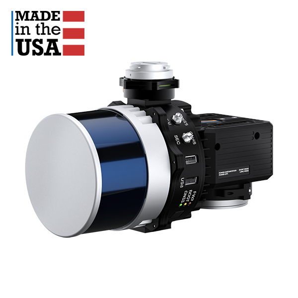
LiDAR
Laser Range Capabilities
80m @ 10% ref. (all channels);
0.05 to 300m
Range Accuracy
+/- 1 cm
FOV (Horizontal)
360°
FOV (Vertical)
40.3°
Scan Angle (Vertical)
-20.8° to 19.5°
Laser Beam Divergence
Number of Laser
32
Number of Returns
3
Pulse Rate
640k/s (single return);
1280k/s (dual return);
1920k/s (triple return)
Laser Safety
Class 1 (IEC 60825-1:2014)
IMU
Inertial Labs Tactica
Grade IMU-P
GNSS
Single or Dual Antenna
Constellations
GPS, GLONASS, Galileo, BeiDou,
QZSS, NavIC (IRNSS), SBAS, L-Band(7)
Frequencies
L1, L2, L5(8)
Operation Modes
RTK and PPK
Output Rates
Up to 200Hz (INS);
Up to 2,000Hz (IMU)
Pitch/Roll Accuracy
0.03° (RTK);
0.006° (PPK)(9)
Heading Accuracy
0.15° (RTK);
0.03° (PPK)(10)
Velocity Accuracy
<0.03 m/s
Position Accuracy
1cm + 1ppm (RTK);
0.5cm (PPK)

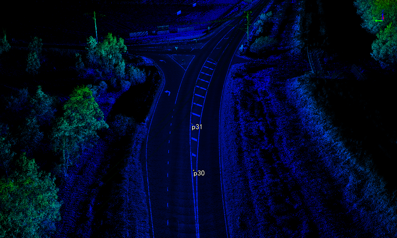
 LiDAR Point Cloud Processing Software
 LiDAR Point Cloud Processing Software
 LiDAR Point Cloud Processing Software
 LiDAR Point Cloud Processing Software
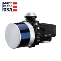 drone lidar with premium INS
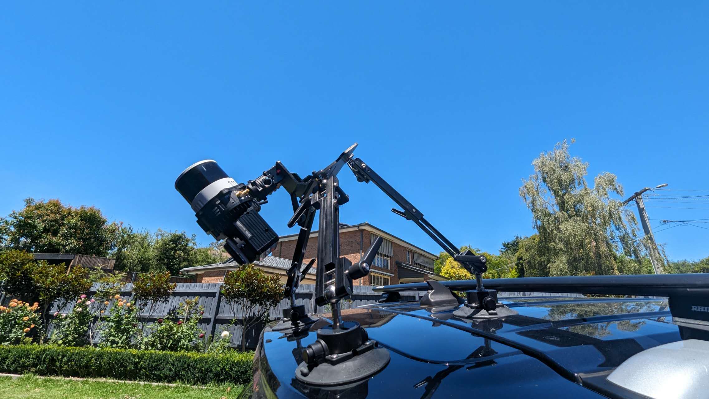
 UAV LiDAR Payloads
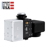 drone lidar with premium INS
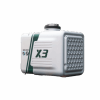 Entry Level drone LiDAR