Find Us In Booth W60

LiPowerline – Powerline Point Cloud Data Analyzing Software – 1 Year Subscription

US$3,600.00 Excl. GST/VAT

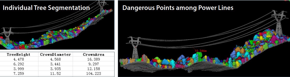
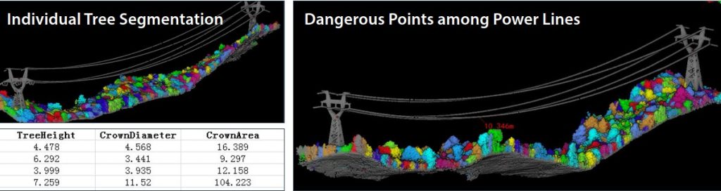
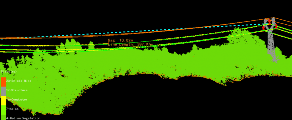
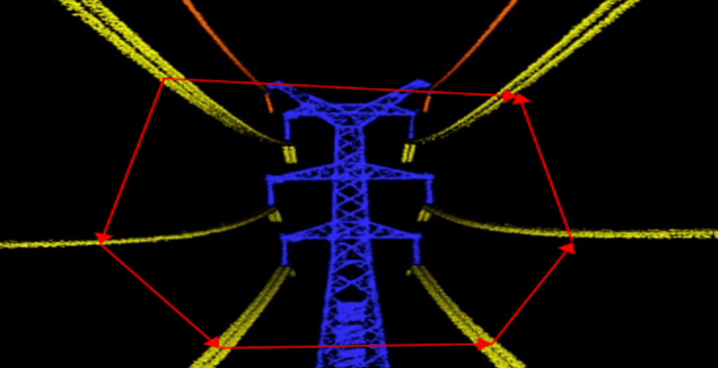
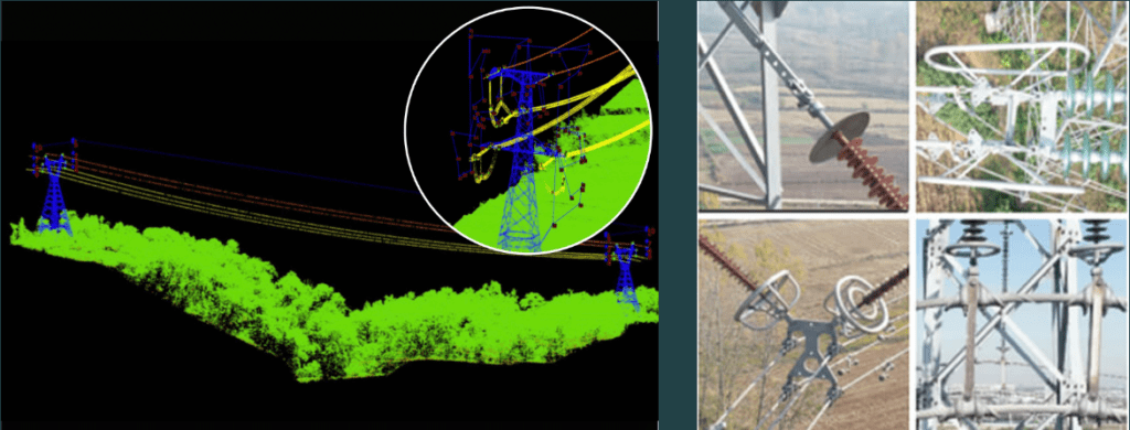
LiPowerline offers an intuitive and highly efficient solution for power line inspection from LiDAR point clouds. This software includes powerful tools for the automatic and manual classifying of power lines, transmission towers, vegetation, buildings, and other objects of interest. The program can be used to automate the detection of userdefined danger points (e.g., vegetation encroachment and tree fall hazards). Built-in reporting functions allow users to quickly generate detailed project reports and results can be exported as KML formatted files.

Table of Contents

Key Features of LiStreet - Road Feature Extraction Software from Point Cloud Data

Real-Time Working Condition Analysis

  • Individual tree segmentation by span/section
  • Extract danger points along power lines
  • Detect singular tree information such as location, height, crown size, etc

Simulate & Predict Environmental Variabilitiy

  • Semi-automated tools for vectorizing insulators, power lines, and transmission towers

  •  

    Influences of tree fall, expected individual tree growth, wind, ice-loading, and air temperature on conductor sag and sway under user-defined environmental conditions

Inspections Based on LiDAR Data

  • LiPowerline was developed to extract information on corridor/right-of-way and assets (e.g., conductors and transmission towers) from LiDAR data. This information can then be used in later analyses, including those that examine phase-spacing, normal height, and inclination conditions, as well as the impacts of different environmental conditions on conductor sag.

Detailed Transmission Tower Inspections

  • Detailed transmission tower inspection: supports capturing a large set of high-resolution images of the main components of each tower and typical issues that analysts can identify using drone-based imagery, including structural issues, missing and backed-out cotter pins, cracked insulators, vegetation concerns, and so on.
  • In short, you can use our system to identify hard-to-find maintenance issues—before they degrade performance or cause a critical failure.
  • Moreover, LiPowerline contains functions that allow users to plan efficient flight routes for transmission tower inspection. These flight plans can then be imported into the ground control software. These flight route planning functions can significantly reduce the cost by improving data collection efficiency. Users can also simulate the flight in the point cloud data before heading to the field to determine if the proposed route is safe or not to fly.
  •  

Video DEMO for LiPowerline

Downloads for LiPowerline

Software Download

Click HERE to download LiStreet

User Manual

User manual of LiPowerline