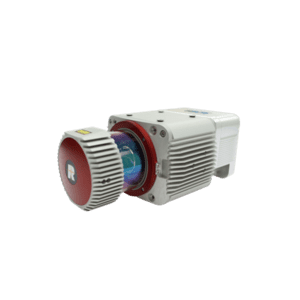
Survey-grade Mobile Laser Scanners - Riegl Laser Sensors
GVI also integrated the RIEGL Laser sensors into mobile laser scanners which provide accurate data at high speeds and are ideal for survey-grade mapping applications. They feature fast data acquisition rates and a high-resolution imaging sensor. They also offer an ultra-wide field of view for greater spatial coverage. A mobile lidar scanner with RIEGL sensors is ideal for a wide variety of commercial applications.
Survey-Grade Mobile Laser Scanners for Infrastructure Projects
A mobile Laser scanner provides high accuracy digital mapping for large infrastructure projects, while limiting traffic disruption and increasing safety. Compared to conventional surveying, it saves on time and costs. Its high speed allows it to survey large areas quickly and efficiently, avoiding delays and traffic snarls. It also requires less manpower than traditional surveying methods, reducing the potential for human error and ensuring the highest level of accuracy.
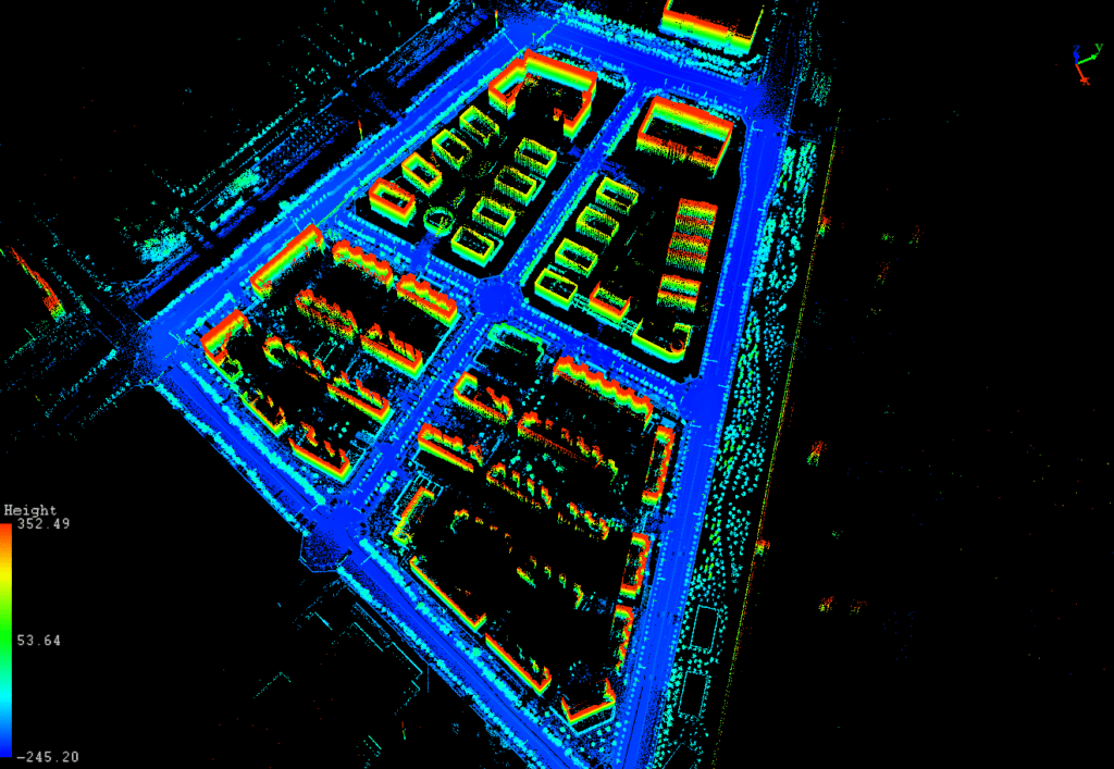
A Mobile laser scanning system incorporates high-resolution LiDAR sensors, spherical vision cameras, and Global Navigation Satellite Systems mounted on a moving platform. It is ideal for mapping linear infrastructure, and uses non-invasive survey methods to create high-resolution 3D point clouds that are usable for engineering design, feature extraction, and Digital Terrain Modelling. A Mobile laser scanning system can also be used to assess the condition of existing infrastructure.
Key Features of Survey Grade Mobile Laser Scanner
Modularization
A range of optional modules is available to fit customers’ specific needs in various of industries.
Integration
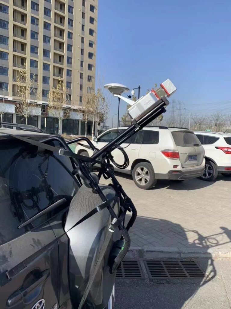
The all-new integrated vehicle mounting system, with pullout design. Highly adaptable to various SUV models.
Control Method
The real-time running condition and the state of the system can be monitored through wireless and wired control.
Lightweight Design
Robust aluminum housing and small PCB boards are adopted to reduce the interior space significantly to compact the size and weight of the system.
Power Supply
Powered by a battery compartment containing a maximum of six easy-carry batteries, it lasts all day without needing a recharge.
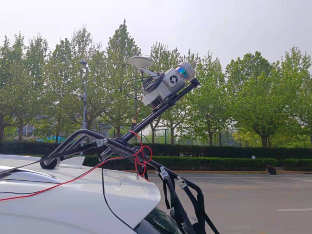
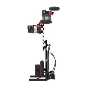
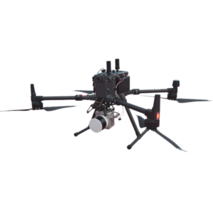
Mobile Laser Scanning System with Riegl MiniVUX -3
Laser Sensor: Riegl MiniVUX-3 UAV
NOSE : APX15 (Configurable)
Range Accuracy: ± 1.5cm Detection Range: 330 m @ 80% reflectance System Accuracy: ± 3 cm @ AGL 80m Target echoes per laser shot: 5 Weight: 1.9 kg (Excl. Camera) 2.1 kg (Incl. Camera)
Mobile laser scanners have a variety of applications, from urban modeling to infrastructure analysis. Listed below are some of the most common uses of mobile LIDAR. If you need to use this technology for mapping projects, there are a number of advantages and disadvantages to consider. Before purchasing a mobile LIDAR, make sure to review the benefits and limitations of the technology.
For example, the mobile lidar scanner can be used to create 3D point clouds while a vehicle is moving. This technology uses an inertial measurement unit and global navigation satellite system to generate a point cloud from range data. Sensor properties such as wavelength, scan frequency, and point measurement rate affect the point cloud characteristics. Several papers have described different sensor layouts and measurements.
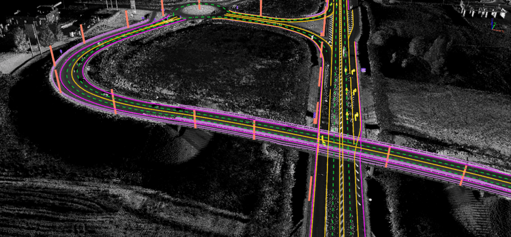
Another application for mobile laser scanners is in 3D mapping along corridors. Unlike other mapping techniques, mobile Lidar systems are capable of capturing high-resolution 3D topographic data at normal speeds. This means that mobile Lidar systems are a great option for surveying various corridors and environments. They provide high-resolution 3D models that far surpass the accuracy of traditional methods.
Mobile LiDAR scanners have numerous applications in road construction. In addition to providing quality control during the construction process, these systems can also produce high-accuracy as-built records. They can be used to compare the data obtained by mobile LiDAR to the original CAD drawings.