
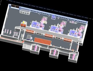
LiDAR Scanning for BIM & Revit Models
LiDAR Scanning For Building Information Modelling (BIM) Services | As-built Documentation | 3D Feature Vectorization BIM has the characteristics of visualization, coordination, simulation, optimization and
Aerial Mapping & Drone Survey With LiDAR
Aerial Mapping and Drone Survey LiDAR Scanning Solutions What is a Drone Survey? A drone survey is a way of gathering data or information that
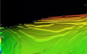
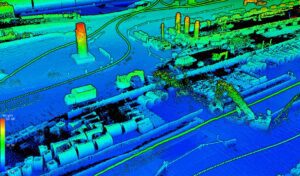
HD LiDAR Mapping Urban Town
HD LiDAR mapping with Mobile & Aerial LiDAR Laser Scanning | Urban & Town Area Using a 3D LIDAR Laser Scanning for HD LiDAR mapping
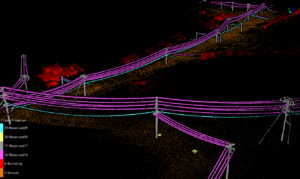
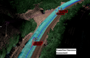
LiDAR Powerline Inspection – Aerial & Terrestrial
Powerline, Transmission Line & Substation Inspection with Drone and Mobile LiDAR Scanners Powerline, transmission line and substation inspection with Drone and Terrestrial LiDAR is an
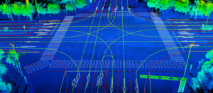
LiDAR Road Survey For Transport Clearance Analysis
Precision LiDAR Road Survey – Vegetation & Powerline Clearance Analysis Using LiDAR to perform a road survey is very useful. It can provide accurate results
LiDAR for Construction
Transform Your Construction Project with Precision LiDAR Scanning Solutions in Australia Accurately capture, model, monitor and manage your construction site with cutting-edge LiDAR technology. LiDAR
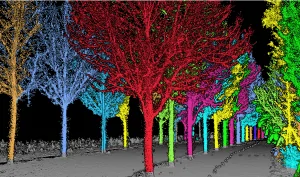
Forestry Survey – LiDAR Survey System and Software
Revolutionize Your Forestry Management with Advanced LiDAR Surveying Welcome to the future of forestry survey and resource management. Our specialized LiDAR forestry services provide unprecedented accuracy, efficiency, and depth