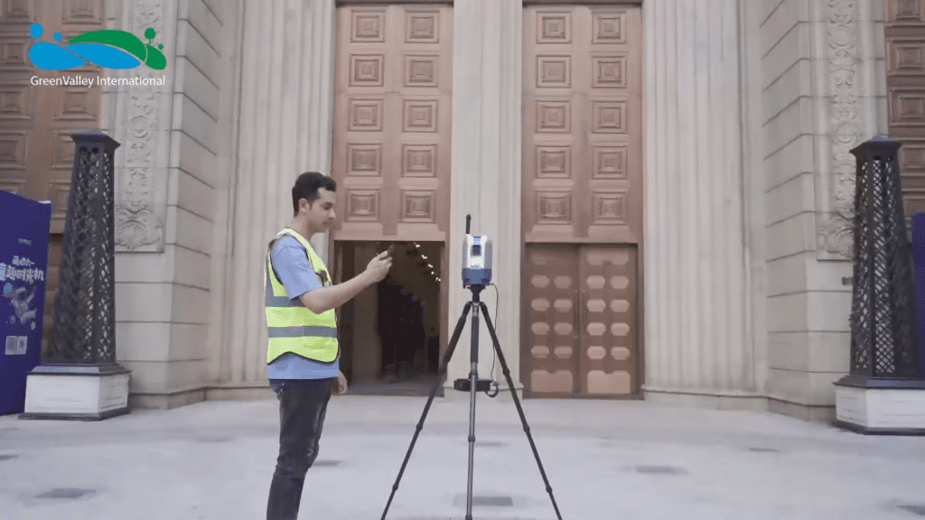
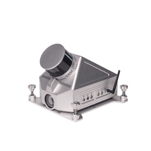
LiPOD - Affordable & Light Weight Terrestrial 3D Laser Scanner
LiPod by GreenValley International makes terrestrial 3D laser scanning (TLS) easier and more affordable than ever before. Its compact and lightweight design makes this high accuracy LiDAR surveying solution easy to transport and operate. LiPod allows users to quickly survey large interior and exterior sites without the need for inserting registration targets.
Key Features of LiPod Terrestrial 3D Laser Scanner
Lightweight Design
The device weighs only 3.0 kg (6.6 lbs) and is equipped with a carbon fiber tripod.
Wireless Control
Connect to and control the system from any WiFienabled device. No cables required.
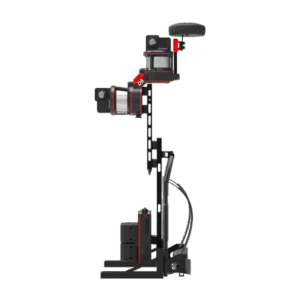
Multi-Sensor Integration
The multiple sensor design with a panoramic camera makes the LiPod more than just a simple 3D laser scanner.
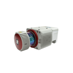
Cost-effective Reliability
The widely adopted VLP-16 sensor from Velodyne LiDAR powers this accurate 3D laser scanning system at an attractive price.
Automatic Leveling
An integrated high-precision, dual-axis compensator allows users to save time leveling the device at each scanning location.
Full Solutions
Build seamless workflows using various pre and post- processing software solutions from GVI to satisfy the needs for various industries.
LiPoD - Terrestrial 3D LiDAR Scanner - Specifications
System Specifications
Dimensions [1] (mm)
117*110*265.5 mm
Battery
5700mAh
Weight [1] (Excl. Battery)
3.0 kg
Battery Life
~4 h / Battery
Storage Capacity
128 GB SSD
Ports
USB, Network
System Control and Data Display
Wireless Mode – Smartphone/Tablet Connect via WIFI, Simultaneous Control and Display
Wired Mode – Wire Connection between System and Tablet, Control and Data Transmission