
Application of Backpack Lidar scanner in the Field of Building Information Modeling
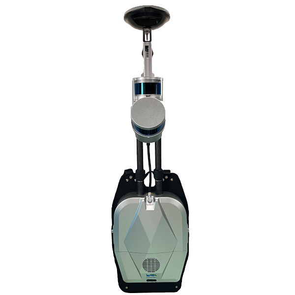
GVI Libackpack DGC50 is a backpack the is a lidar scanner with the function of collecting high-precision geographic coordinate information point cloud and panoramic image.
With the help of GPS positioning information, combined with lidar and Simultaneous Localization And Mapping (SLAM) technology, the LiBackpack DGC50 backpack lidar scanner can obtain laser point clouds and panoramic image data with high-precision geographic coordinate information, even in In areas where GNSS is partially lacking, laser point cloud data with high-precision geographic information can also be obtained, so it is an ideal LiDAR building scan applications especially for indoor and underground mapping.
In addition to the BIM field, the equipment has also been widely used in indoor and outdoor LiDAR building mapping, underground space information acquisition, tunnel engineering, digital factories, digital mines, and forestry resource censuses.

BIM, short for Building Information Modeling, was first proposed by Autodesk in 2002 and has been widely recognized by the industry worldwide.
It can help to realize the integration of building information, from the design, construction, operation of the building to the end of the whole life cycle of the building, and integrate all kinds of information into a 3D model information database.
The design team, the construction unit, the facility operation department, and the owner can work together based on BIM to effectively improve work efficiency, save resources, reduce costs, and ultimately achieve sustainable development.
The core of BIM is to establish a virtual three-dimensional model of construction engineering and use digital technology to provide a complete and actual construction engineering information database for this model. The information base not only contains the geometric information, professional attributes and state information describing building components, but also the state information of non-component objects (such as space and motion behavior).
With the help of this three-dimensional model containing construction engineering information, the information integration degree of construction engineering is greatly improved, thereby providing a platform for the exchange and sharing of engineering information for the stakeholders of the construction engineering project.
BIM has the characteristics of visualization, coordination, simulation, optimization and drawing, while 3D laser scanning technology has the characteristics of data authenticity and accuracy. By scanning the construction site with 3D lasers and cameras, we can obtain real and accurate data, establish a BIM system model, and obtain information on building dimensions and internal facilities layout, and provide information and visualization solutions for engineering quality inspection and renovation plan design. Therefore, it is of great importance. practical meaning.
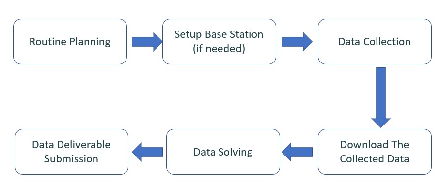
2.1 Path Planning
Before data collection, site exploration and planning must be carried out. In order to better perform data collection and high-quality data acquisition, it is recommended to conduct a survey before formal data collection, walk through the entire scanning area in advance, and plan a walking path.
2.2 Data collection
⬤ Hardware selection
LiBackpack DGC50 is an indoor and outdoor integrated lidar 3D scanning system with the function of collecting high-precision geographic coordinate information point cloud and panoramic image.
With the help of GPS positioning information, combined with lidar and Simultaneous Localization And Mapping (SLAM) technology, the LiBackpack DGC50 backpack lidar scanning system can obtain laser point clouds and panoramic image data with high-precision geographic coordinate information, even in In areas where GNSS is partially lacking, laser point cloud data with high-precision geographic information can also be obtained.
In addition to the BIM field, the equipment has also been widely used in indoor and outdoor integrated measurement, underground space information acquisition, tunnel engineering, digital factories, digital mines, and forestry resource censuses.
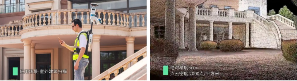
⬤ Outdoor data collection
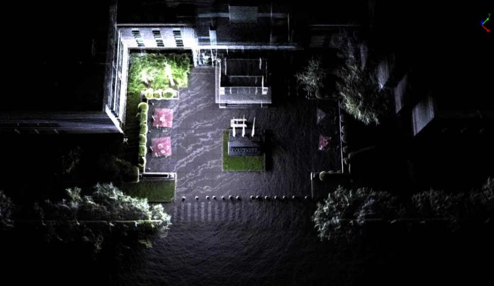
Find an outdoor area, click the Start button at the bottom of the user interface, when the real-time point cloud, IMU and GPS information appear in the main window of the display screen, wait for the GPS state to change to the Locked state, and the number of collected stars is more than 20, you need to walk one The “8” route takes about 1 minute, and then you can start scanning according to the planned route.
2.3 Backpack LiDAR Building Mapping Data preprocessing
Through the LiFuser-BP software developed by GVI, the data is preprocessed, including data calculation, denoising, smoothing, etc., so that users can obtain the best original point cloud data.
2.4 Backpack LiDAR Building Scan Data post-processing
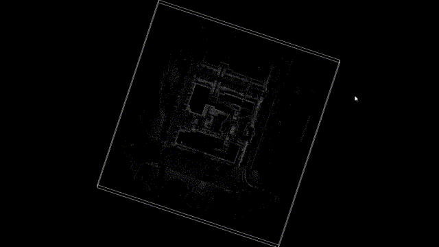
⬤ Data cropping
First of all, the LiDAR360 software of the GVI performs segmentation and slicing processing on the overall point cloud, which is convenient for vectorization operations.
⬤ Vector editing
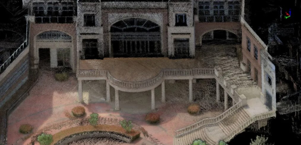
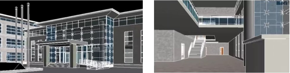
The laser point cloud data scanned by the LiBackpack SLAM lidar system can intuitively display various features of the building itself, including information such as doors and windows, walls, columns, etc., by using the LiDAR360 software developed by our company; the point cloud insertion of AutoCAD function, which can easily import point cloud and capture the edge of point cloud for drawing.
⬤ Vector editing
The laser point cloud data scanned by the LiBackpack SLAM lidar system can intuitively display various features of the building itself, including information such as doors and windows, walls, columns, etc., by using the LiDAR360 software developed by our company; the point cloud insertion of AutoCAD function, which can easily import point cloud and capture the edge of point cloud for drawing.
Pingback: Land Mapping With Aerial Evaluating – Site Title