LiDAR Scanning For Building Information Modelling (BIM) Services | As-built Documentation | 3D Feature Vectorization
BIM has the characteristics of visualization, coordination, simulation, optimization and drawing, while 3D laser LiDAR scanning technology has the characteristics of data authenticity and accuracy. Scan the construction site with 3D lasers and cameras to obtain real and accurate data, establish a BIM system model, obtain building dimensions, internal facility layout information, as-built documentation, 3D feature vectorization, and provide information and visualization solutions for project quality inspection and renovation plan design, which is of great practical importance.
What is Building Information Modelling (BIM)?
BIM (Building Information Modeling) technology was first proposed by Autodesk in 2002 and has been widely recognized by the industry around the world. It can help realize the integration of building information, from building design, construction, operation to the end of the building’s full life cycle , all kinds of information are always integrated in a 3D model information database, the design team, construction unit, facility operation department and owners can work together based on BIM, effectively improve work efficiency, save resources, reduce costs, and achieve sustainable Continuous development.
The core of BIM is to establish a virtual three-dimensional model of architectural engineering and use digital technology to provide a complete architectural engineering information library for this model that is consistent with the actual situation. The information base not only contains geometric information, professional attributes and state information describing building components, but also contains state information of non-component objects (such as space and motion behavior). With the help of this 3D model containing construction engineering information, the degree of information integration of construction engineering has been greatly improved, thus providing a platform for engineering information exchange and sharing for stakeholders in construction engineering projects.
LiDAR Scanning for Building Information Modelling
LIDAR (Light Detection and Ranging) is a remote sensing technology that uses lasers to measure the distance to an object or surface. In the context of Building Information Modeling (BIM), LIDAR can be used to create detailed 3D models of buildings and other structures. These models can be used for a variety of purposes, including design, construction, and maintenance. LIDAR can capture data quickly and accurately, and can be used to create models of both the exterior and interior of buildings. In BIM, LIDAR data can be used to create highly detailed and accurate models that can be used for design, construction, and maintenance purposes.
LiDAR point cloud data acquisition platform for BIM - SLAM LiDAR Scanners
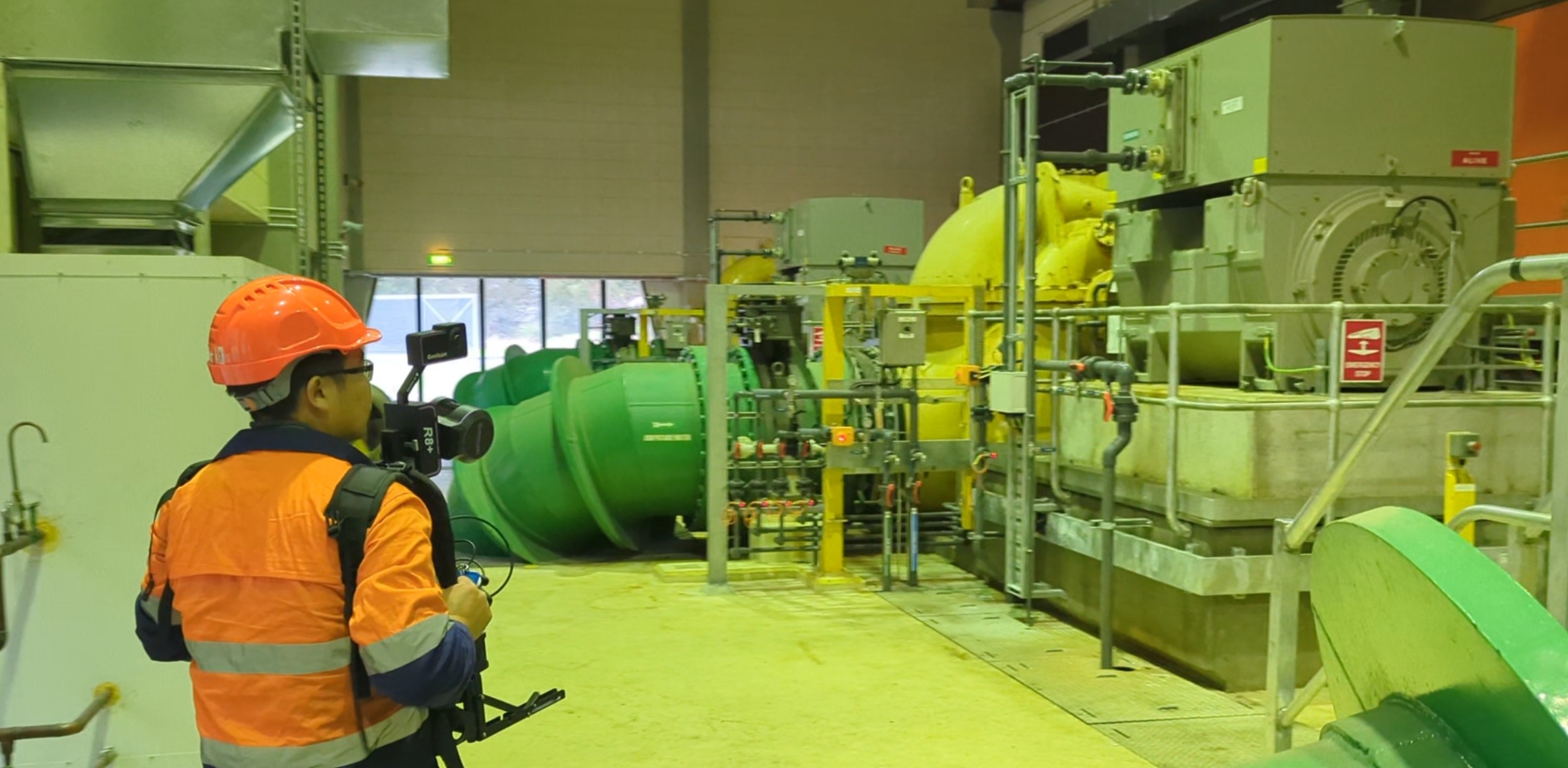
At LiDAR Solutions Australia, we have strategically adopted millimeter-accurate SLAM LiDAR scanners. This technology enables us to dramatically improve on-site scanning efficiency while maintaining the high data quality essential for precision modeling, directly addressing the traditional limitations of TLS.
Here is a comparative analysis:
Traditional TLS Limitations:
Multiple stationary setup requirements
Lengthy capture times for comprehensive coverage
Registration challenges between scan positions
Difficult in occupied or operational spaces
Higher risk of missing areas between setups
Our SLAM Advantage:
Continuous mobile scanning capability
Single-operator efficiency
Automatic real-time registration
Complete coverage in single passes
Operational environment compatibility
Reduced safety risks with less equipment setup
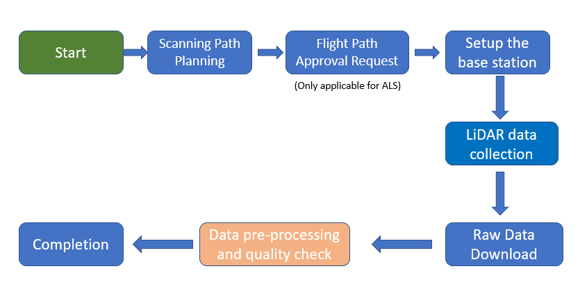
LiDAR point Cloud to BIM Workflow
The point cloud data of the surface of the object is obtained through a 3D laser LiDAR scanner. The point cloud data contains the 3D coordinates information of the surface of the objects. At the same time, the texture and color information of the object can be collected through the camera to provide a data basis for building a high-precision BIM model.
LiDAR Data Collection Workflow
LiDAR Scanning Workflow
LiDAR Data Collected
Workflow for BIM LiDAR Data Processing
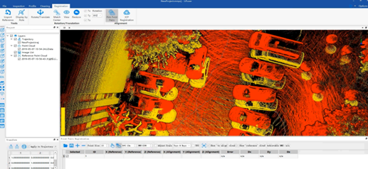
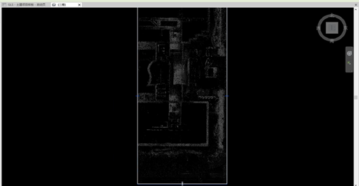
Register and cut point cloud data to realize multi-site cloud data splicing and fusion
Point Cloud Registration
Point Cloud Cut
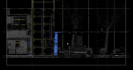
Classify and Vectorize the Point Cloud Data and Acquire the Contour of Object
Point Cloud Vectorization
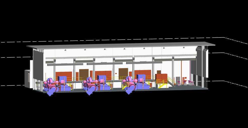
Input the Vector File into Modelling Software for BIM
Model Building
Contact Us
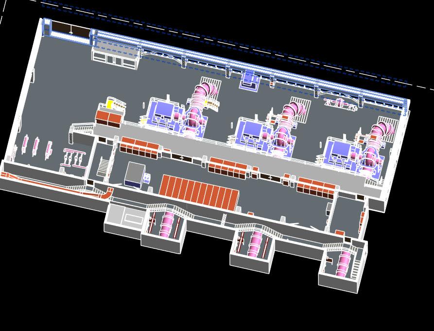
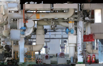
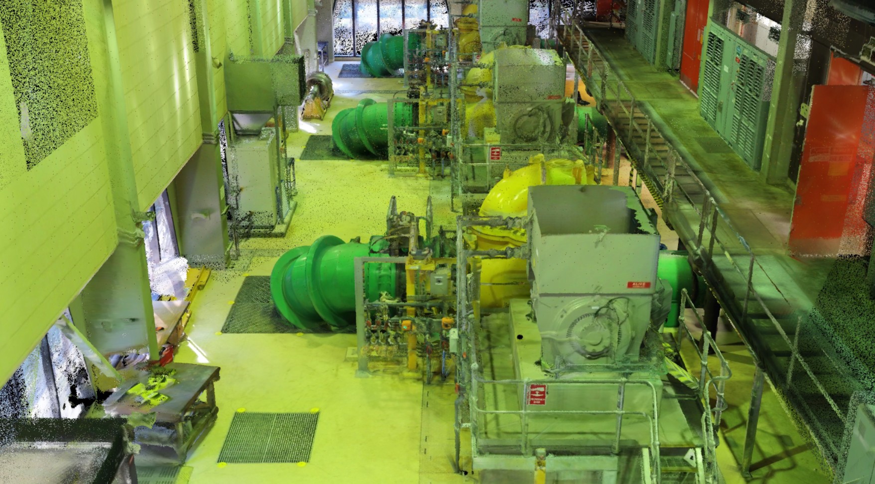
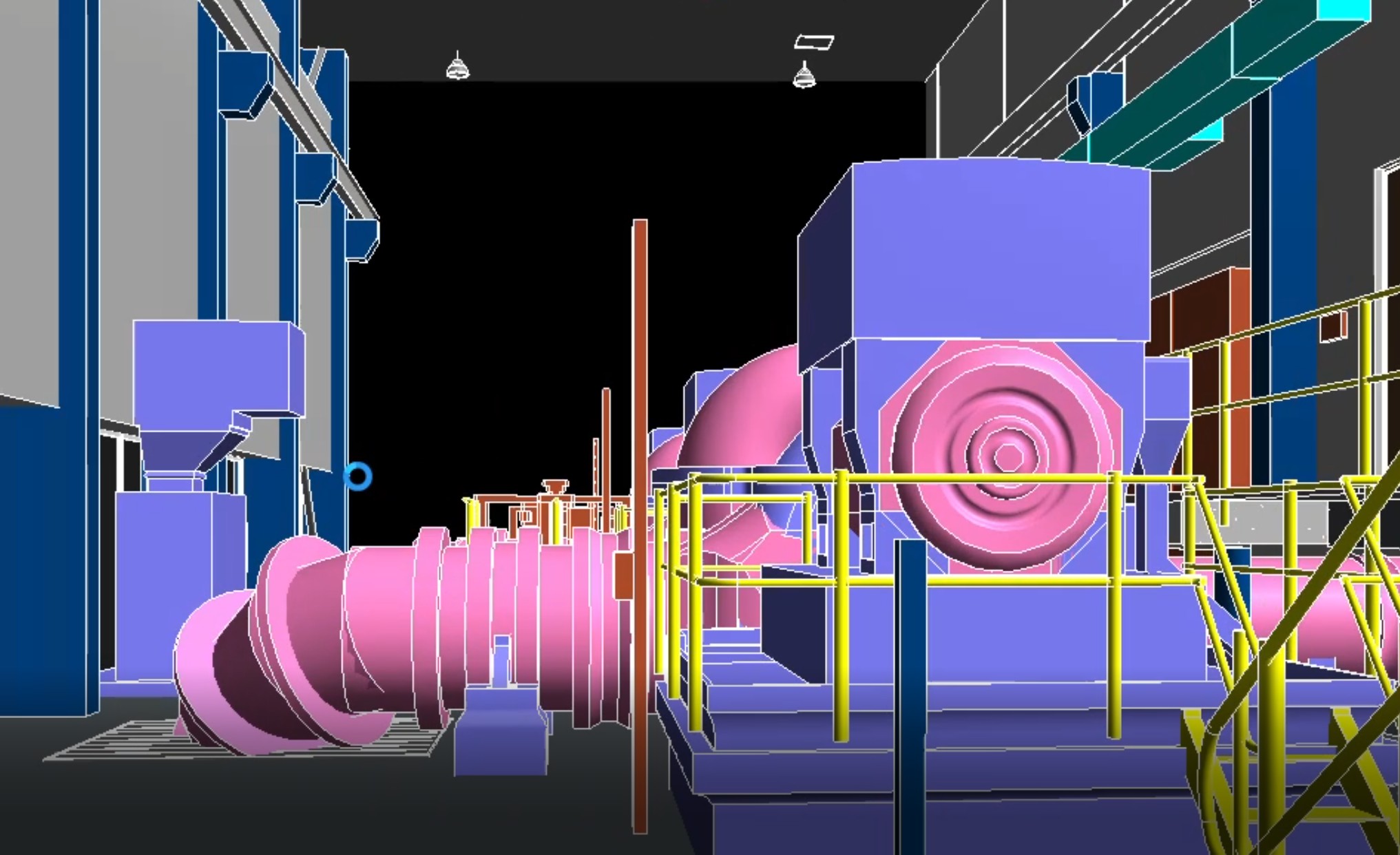
Case Example
Project: Melbourne Water, Sugarloaf Reservoir Scope: LiDAR Scan to Revit Model Conversion Our premium SLAM LiDAR scanner captured this critical water facility in high definition. The resulting point cloud was expertly translated into an intelligent, actionable Revit model. Visual Workflow: Site → Point Cloud → BIM Model
The visual progression below illustrates the transformation: from the original site photograph, to the high-density point cloud, and finally to the detailed BIM-ready Revit model.