Powerline, Transmission Line & Substation Inspection with Drone and Mobile LiDAR Scanners
Powerline, transmission line and substation inspection with Drone and Terrestrial LiDAR is an effective way to identify potential issues before they impact your electrical infrastructure. LiDAR sensors can capture multiple echoes and provide accurate location and coordinates of electrical facilities, ground objects, and vegetation. Using LiDAR can also improve inspection efficiency.
Benefits for LiDAR Transmission Line & Substation Inspection
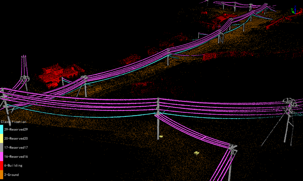
Classified Powerline for Neara Modeling
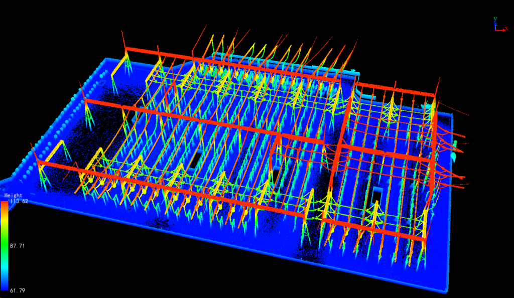
3D Point Cloud for Substation
Powerline, transmission line and substation inspection is a necessary step in power distribution infrastructure maintenance. It prevents outages by monitoring the infrastructure and identifying issues that could compromise the integrity of power lines. Power outages cause massive economic losses and threaten the natural ecosystem. In addition to short circuits, powerline inspection can also detect other power distribution anomalies that could threaten power quality.
Aerial systems equipped with LiDAR capture data from target areas of powerline, transmission line and substation infrastructure. These data are processed to create a 3D map & model that shows the distances between powerlines and surrounding vegetation. This mapping data allows operators to focus their efforts on the areas that pose the greatest threat to power lines. Because LiDAR is fast and accurate, operators can use it to detect sagging wires, dangerous trees, and other potential hazards.
Aerial mapping is another option for powerline inspection that is cost-effective and saves time. An aerial survey can map up to 50 km of transmission lines in a single day, saving grid operators time on the ground and reducing labor costs by up to 50%. Aerial mapping uses a full-frame camera and in-house algorithms to produce lidar-quality data.
Lidar technology has the ability to visualize powerlines and identify problems that can affect their safety. It is used to inspect high-voltage powerlines and detect any problems before they cause damage to the electrical network. It can also detect the presence of vegetation that could pose a risk to power lines. The use of lidar technology can help utility companies to minimize the costs and risks of power line inspection.
LiDAR power line inspection can help grid operators to map wire profiles, which is particularly important in regions with high traffic density and large machinery movement. These inspections also help grid operators to react to potential problems before they cause damage to the network. A single powerline span can be inspected in as little as ten minutes with a single technician or two.
Drones equipped with LiDAR can survey target areas and generate a 3D map that shows the distance between powerlines and vegetation. This allows operators to avoid clearing large areas and focus their efforts on the most dangerous areas. LiDAR is also used to detect sagging wires and potential tree fall.
LiDAR System for Powerline Inspection
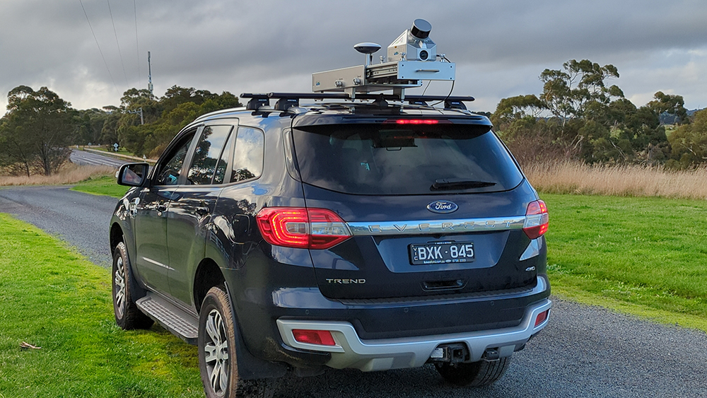
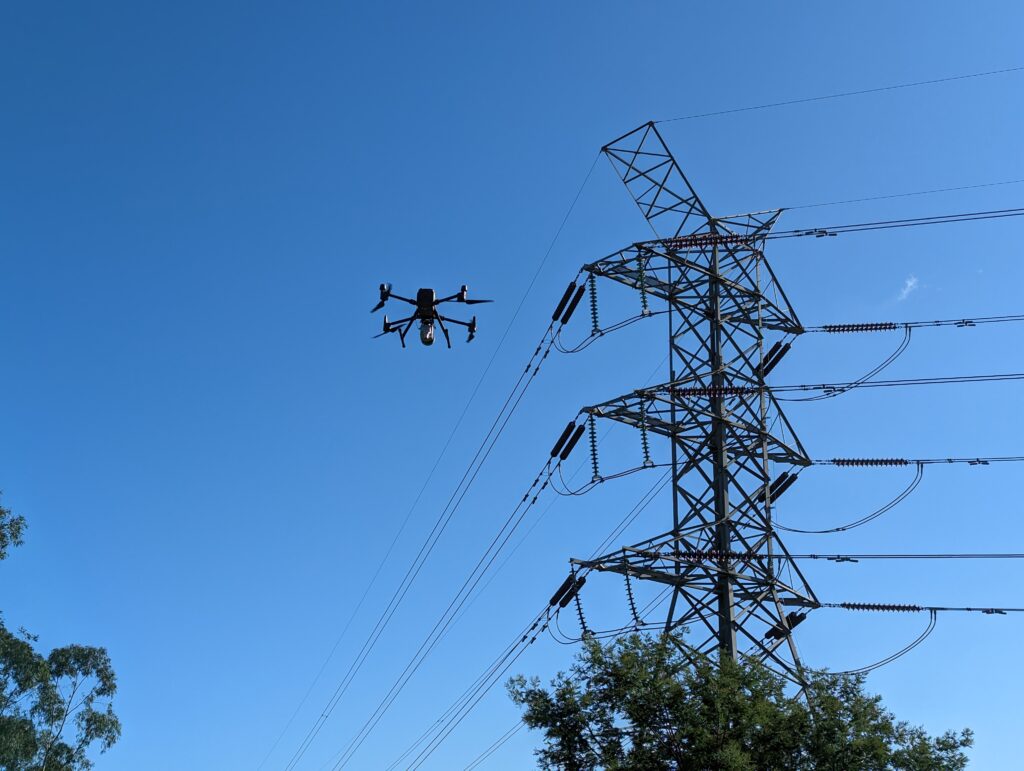
LiDAR Solutions Australia possesses backpack, vehicle-mounted, and drone-based LiDAR scanning systems capable of operating under diverse site conditions. These systems are designed to meet efficiency, environmental, health, and safety (EHS), and data quality standards.
This flexibility allows for tailored data collection strategies that adapt to specific project needs, ensuring that all operations are conducted with optimal precision and safety. The various deployment options provided by LiDAR Solutions Australia enable comprehensive coverage and high-resolution data acquisition, essential for detailed analysis and decision-making in a range of industries.
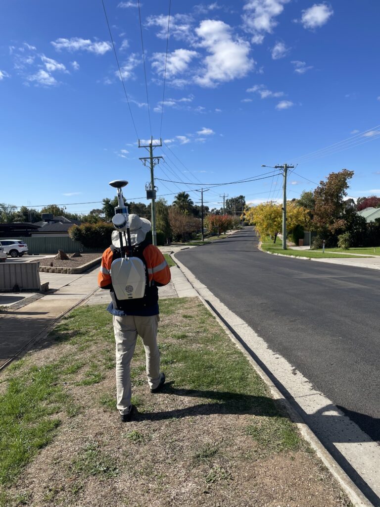
Site Photos:
Vehicle-mounted LiDAR Scanning System
Drone LiDAR Scanners
Backpack LiDAR Scanners
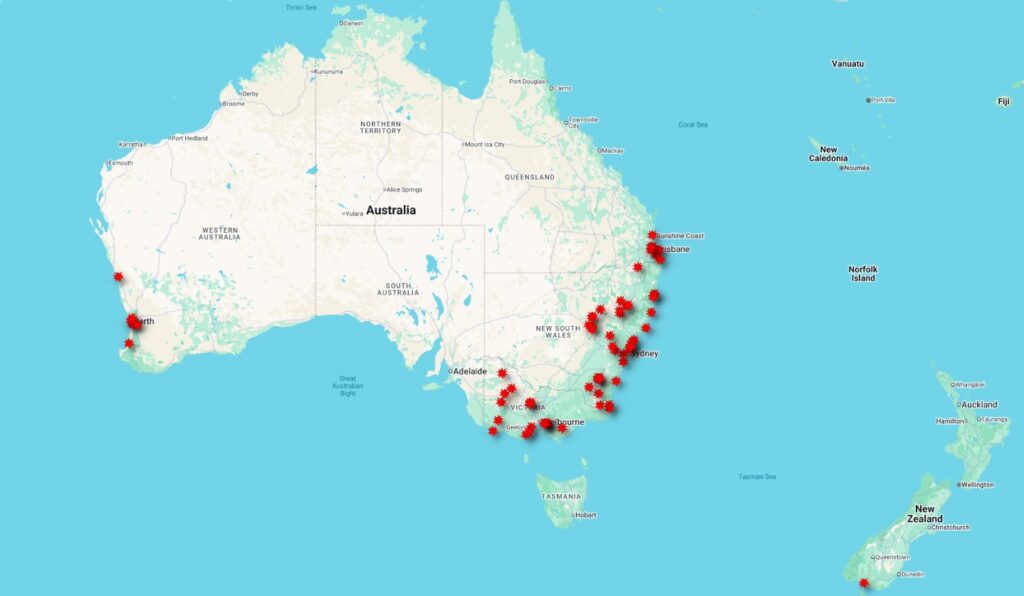
Our Project Footprint for LiDAR Powerline Inspection in Australia & New Zealand
LiDAR Solutions Australia, a pioneering firm in light detection and ranging technology, has successfully completed over 20 projects throughout Victoria and New South Wales. The company employs a variety of LiDAR systems, including terrestrial, vehicle-mounted, and drone-mounted technologies. This versatile approach allows them to deliver precise, high-resolution 3D models across diverse environments, enhancing planning and decision-making processes in various industries.
Why Our Customers Choose Us?
End to End Solutions and services
Multi terrestrial and aerial LiDAR system can be used to meet the various site conditions
Deliver the precise data and report as per your requirements