
Large‑Scale Powerline Survey for Ground Clearance and Vegetation Management
High-Volume Utility LiDAR Surveying for NBN Fibre Connect Program
Project Location: Canberra, ACT, Australia
Project Name: 9BLC-20, 9DKI-20 NBN SAM
Client: APD Global, Ventia, ServiceStream, NBN Co
Industry: Telecommunications / Utility Infrastructure
1. Executive Summary
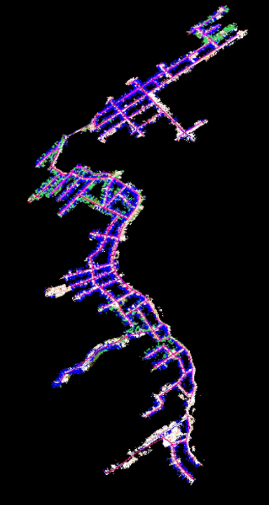
This case study examines a landmark LiDAR surveying project undertaken by LiDAR Solutions in Canberra, ACT, as part of NBN Co’s ambitious Fibre Connect program. The project—codenamed 9BLC-20 and 9DKI-20—required the comprehensive 3D mapping of over 1,500 utility poles and more than 4,000 residential premises to support NBN’s Node-to-Premises (N2P) design and Fibre-to-the-Premises (FTTP) upgrade rollout. Working in partnership with tier‑one telecommunications contractors Ventia and ServiceStream—both key NBN-approved delivery partners—LiDAR Solutions deployed an innovative combination of SLAM LiDAR scanning technology, laser-equipped RTK rovers, and a proprietary project management platform called SyncSight to overcome significant access and data management challenges. The project was completed successfully, demonstrating LiDAR Solutions’ capability to execute complex, high‑volume surveying assignments for Australia’s most critical national infrastructure programs.
2. Project Background
2.1 The NBN Fibre Connect Program
NBN Co’s Fibre Connect program represents one of Australia’s largest telecommunications infrastructure upgrades. The program seeks to deploy additional fibre infrastructure across the nation, enabling eligible premises currently served by Fibre-to-the-Node (FTTN) technology to upgrade to Fibre-to-the-Premises (FTTP). Under the N2P Evolution agreements, NBN Co has contracted multiple delivery partners—including Ventia, ServiceStream, Downer, Fulton Hogan Utilities, and Lendlease Services—to undertake design and construction work valued at over $1.1 billion.
The N2P program (short for “node to premises”) aims to overbuild half of the FTTN network with full fibre at a cost of almost $3 billion. Ventia’s involvement under its N2P Evolution deal is expected to deliver approximately $400 million in revenue over 2.5 years, while ServiceStream has secured additional works across Queensland, New South Wales, Victoria, and the ACT.
2.2 Project Scope
The 9BLC-20 and 9DKI-20 projects were commissioned to support the detailed design phase of the NBN Fibre Connect rollout in the Australian Capital Territory. The specific scope required LiDAR Solutions to:
Survey over 1,500 utility poles across suburban Canberra, capturing precise 3D coordinates, structural conditions, and existing attachment configurations
Map more than 4,000 residential premises, documenting the current cable and telecommunications connection status at each location
Deliver comprehensive 3D utility models suitable for integration into NBN’s design and engineering workflows
Provide accurate, georeferenced data to enable efficient FTTP upgrade planning, including the routing of new fibre connections from the street to each premises
The project was executed on behalf of Ventia and ServiceStream, who engaged LiDAR Solutions as a specialist surveying subcontractor to deliver the high‑precision spatial data required for the N2P design phase.
3. The Challenge
3.1 Access Constraints: Assets in Rear Yards
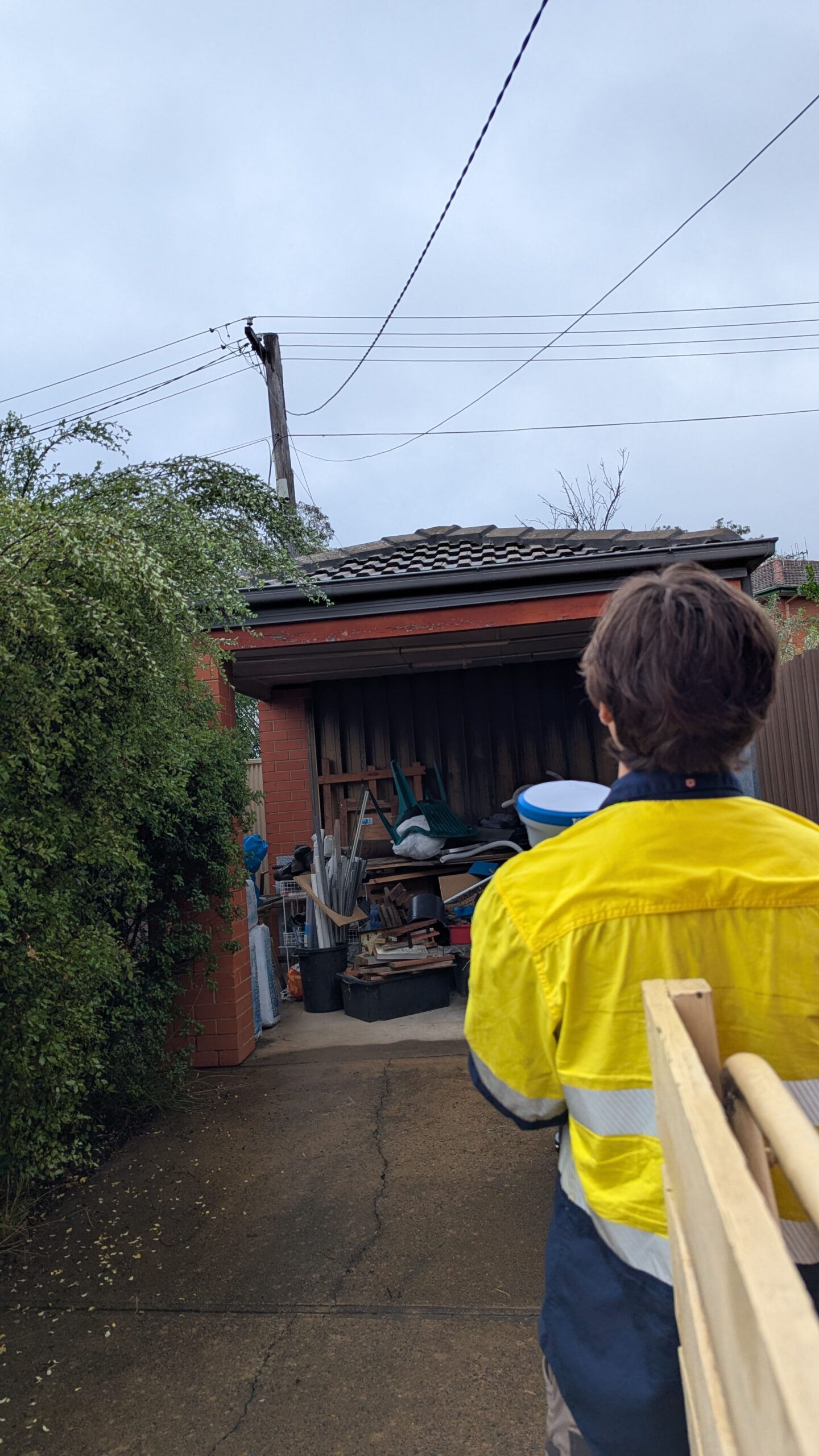
The most significant operational challenge was the physical location of the assets to be surveyed. A substantial proportion of the utility poles and telecommunications infrastructure targeted in this project were situated in rear yards—behind residential properties, accessible only through narrow side passages, gates, or over fences. This created several compounding difficulties:
Permission and coordination complexity: Gaining access to private property required extensive coordination with residents, often involving multiple visit attempts and schedule adjustments
Limited manoeuvrability: Rear‑yard environments are typically constrained by fences, garden beds, sheds, clotheslines, and other obstacles that restrict movement and equipment setup
Safety considerations: Navigating rear yards introduced additional occupational health and safety risks, including uneven terrain, trip hazards, and the presence of pets or unsupervised children
Time inefficiency: The need to repeatedly seek access, wait for occupants, and negotiate entry points dramatically reduced the number of assets that could be surveyed per day using conventional methods
3.2 Data Management Complexity
Beyond the physical access challenges, the project generated an enormous volume of diverse data types that needed to be captured, processed, quality‑controlled, and delivered within tight project timelines:
Massive point cloud datasets: Surveying 1,500 poles and 4,000 premises using traditional static LiDAR or total station methods would have produced terabytes of raw scan data requiring extensive post‑processing
High‑volume photographic documentation: Each asset required multiple geotagged photographs to document condition, connections, and surrounding context—amounting to tens of thousands of images. We took average 15 photos per asset, and in total we delivered 97,500 photos to the client. And all photos are sorted by projects and assets.
RTK survey observations: Precise GNSS coordinates needed to be captured for each pole and premises, requiring systematic data logging and quality assurance
Integration challenges: Data from multiple sources (LiDAR point clouds, RTK observations, photographs, field notes) needed to be correlated, cross‑referenced, and delivered in a unified format suitable for NBN’s design systems
Progress tracking: With multiple survey teams operating simultaneously across the ACT, maintaining real‑time visibility into project progress, data completeness, and quality assurance was essential but difficult to achieve with conventional project management tools

3.3 Project Scale and Timeline
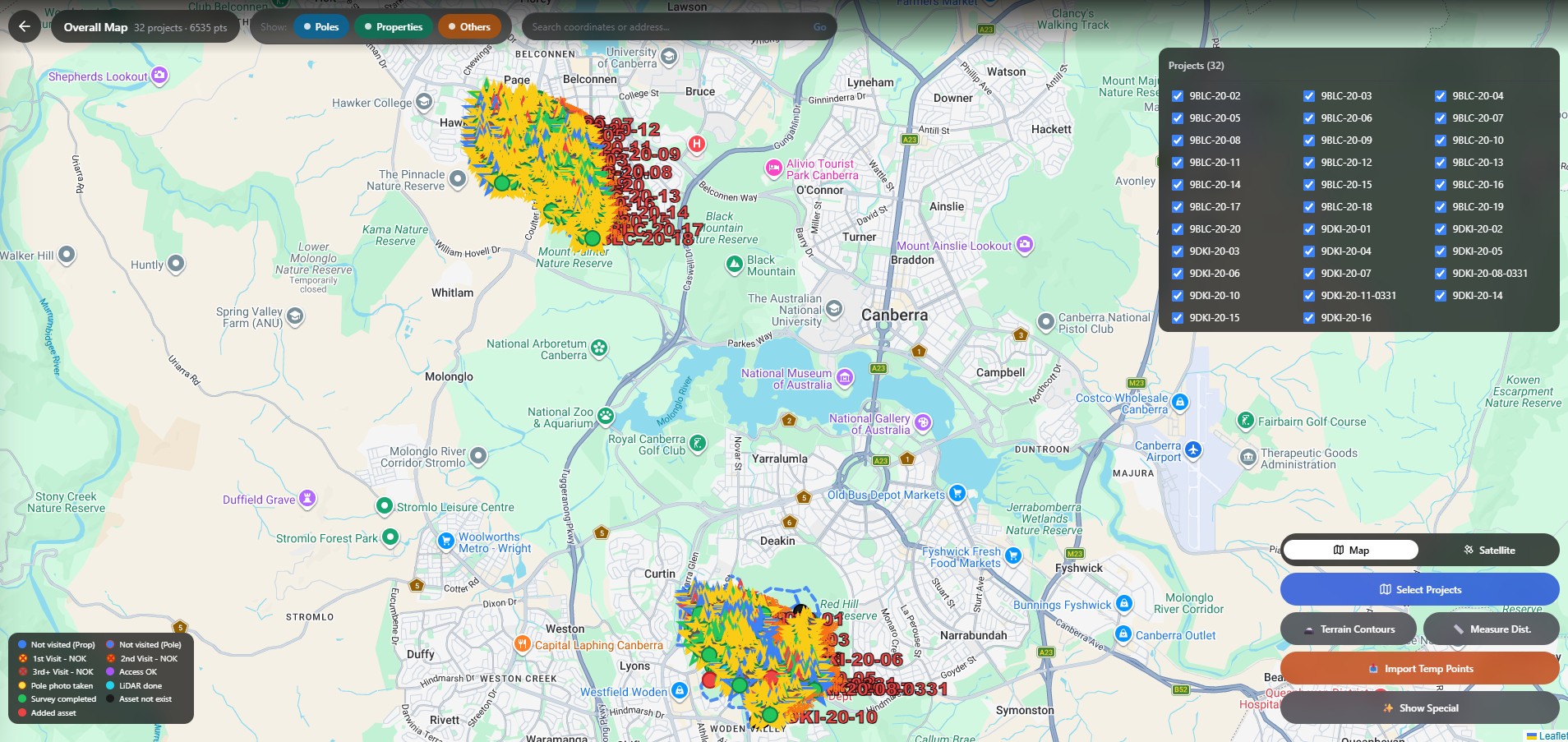
The sheer scale of the project—5,500+ individual assets to be surveyed across a geographically dispersed urban area—demanded a surveying approach that balanced speed, accuracy, and cost‑effectiveness. Traditional surveying methods would have required months of fieldwork, extensive manual data entry, and prolonged post‑processing cycles, potentially delaying the NBN design and construction schedule.
4. The Solution
LiDAR Solutions developed and deployed an integrated technology solution that addressed both the access and data management challenges head‑on.
4.1 SLAM LiDAR Scanning Technology
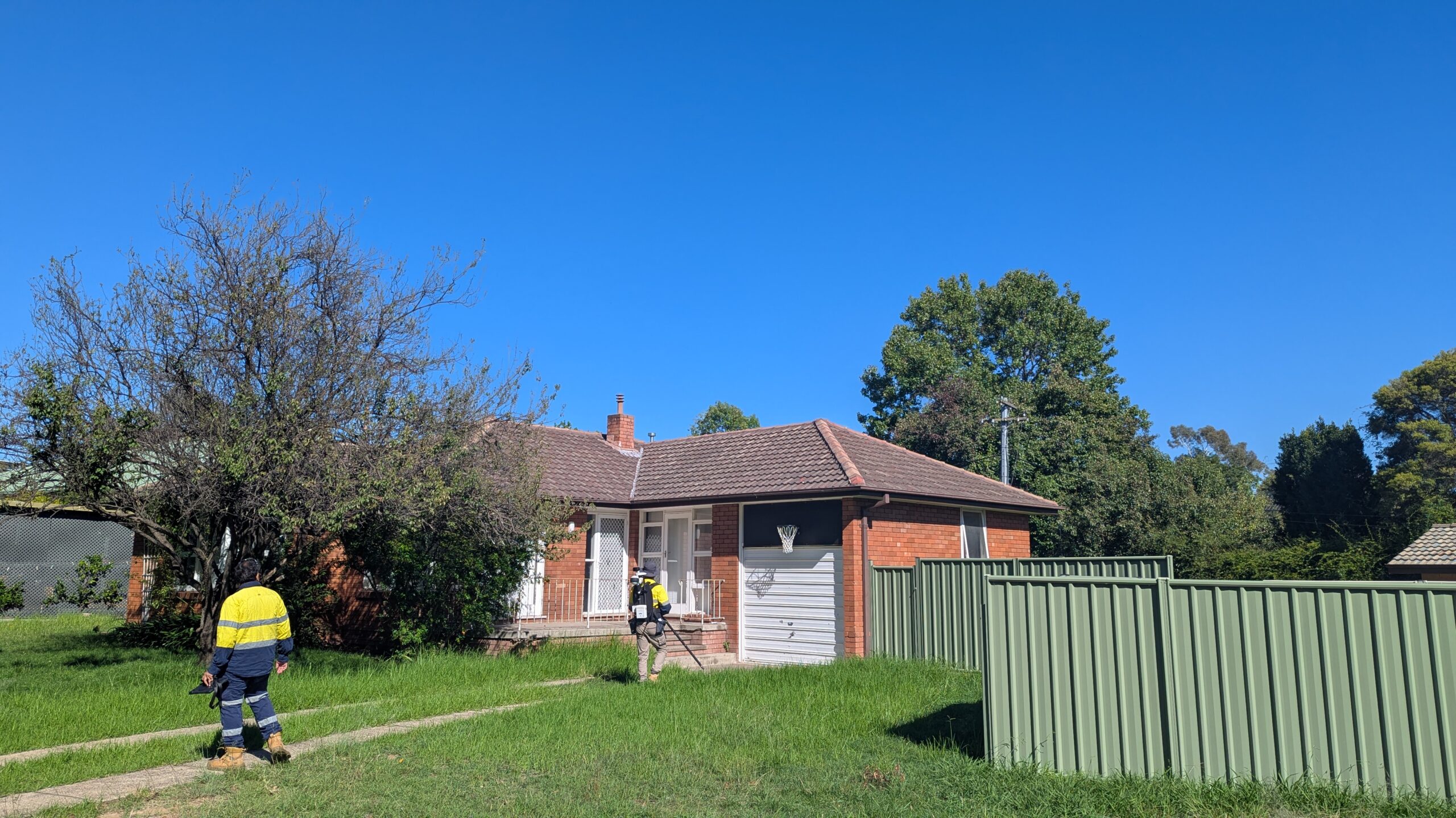
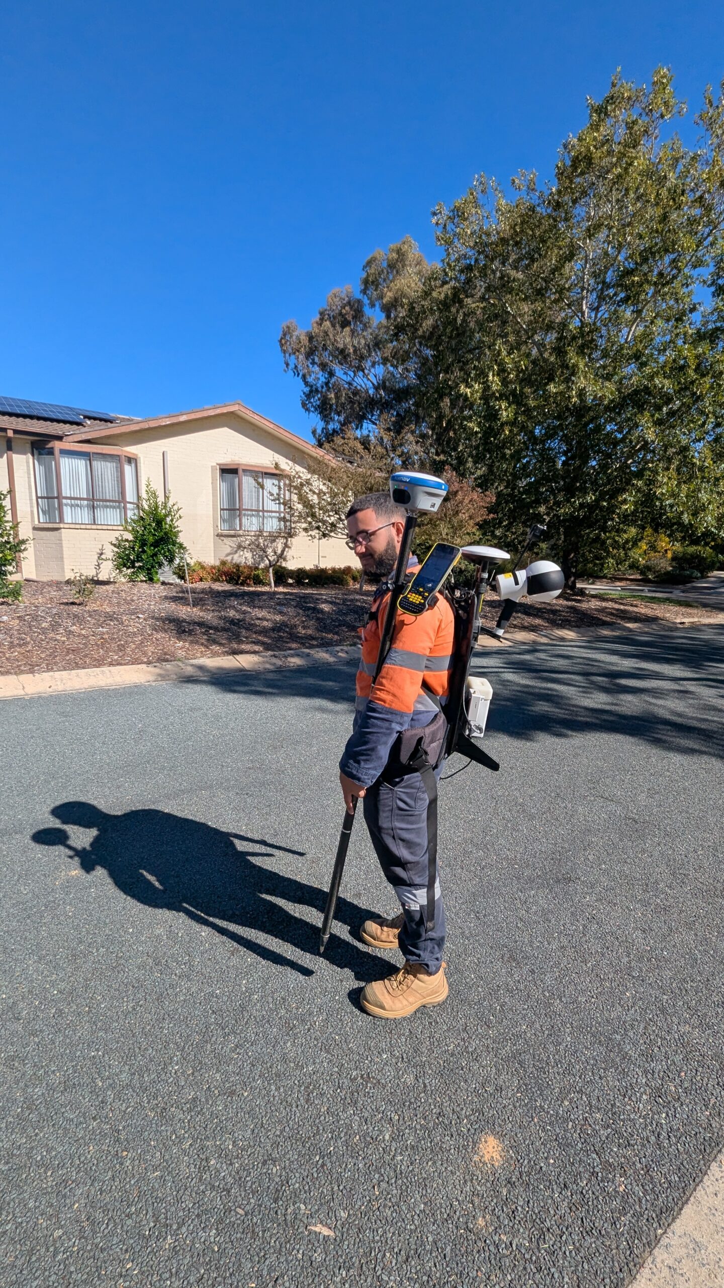
To overcome the rear‑yard access challenge, LiDAR Solutions deployed handheld SLAM (Simultaneous Localisation and Mapping) LiDAR scanners for pole and premises surveying. SLAM technology offers several critical advantages for this type of work:
Walk‑and‑scan capability: Surveyors could walk through narrow side passages and rear yards while continuously capturing 3D point cloud data, eliminating the need to set up tripods or establish instrument stations
GNSS‑denied operation: SLAM algorithms enable accurate positioning even in environments with limited or no GNSS reception—such as between buildings or under dense tree canopy—by continuously mapping the surrounding environment
Rapid data capture: A single operator could survey an entire rear yard and its associated utility assets in minutes, compared to the 30‑60 minutes typically required for conventional static scanning
Reduced property intrusion: The handheld form factor was less intrusive than larger equipment, improving resident cooperation and reducing access refusals
Each SLAM scan captured a dense 3D point cloud of the utility pole, its attachments, and the surrounding premises, providing the fundamental data for subsequent 3D modelling.
4.2 Laser‑Equipped RTK Rover
For precise georeferencing and control, LiDAR Solutions deployed RTK (Real‑Time Kinematic) rovers equipped with integrated laser rangefinders. This combination delivered:
Centimetre‑level absolute accuracy: RTK GNSS provided survey‑grade positioning for each asset, ensuring the SLAM point clouds could be accurately georeferenced
Efficient control point capture: The laser rangefinder enabled rapid measurement of offset distances to pole bases and premises corners without needing to physically occupy each point
Seamless integration with SLAM data: RTK observations were used to constrain and validate the SLAM-derived positions, delivering a hybrid solution that combined the speed of SLAM with the accuracy of RTK
Reduced revisit requirements: With real‑time centimetre‑level positioning, surveyors could confirm data quality in the field, minimising the need for return visits
4.3 SyncSight: Proprietary Project Management Platform
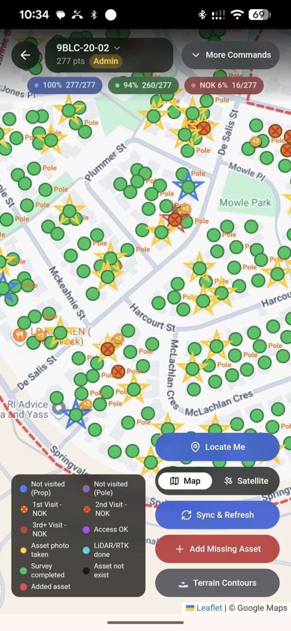
Perhaps the most innovative element of LiDAR Solutions’ approach was the use of SyncSight, a purpose‑built project management platform developed internally to handle the complexity of large‑scale LiDAR surveying projects.
SyncSight provided end‑to‑end project management capability:
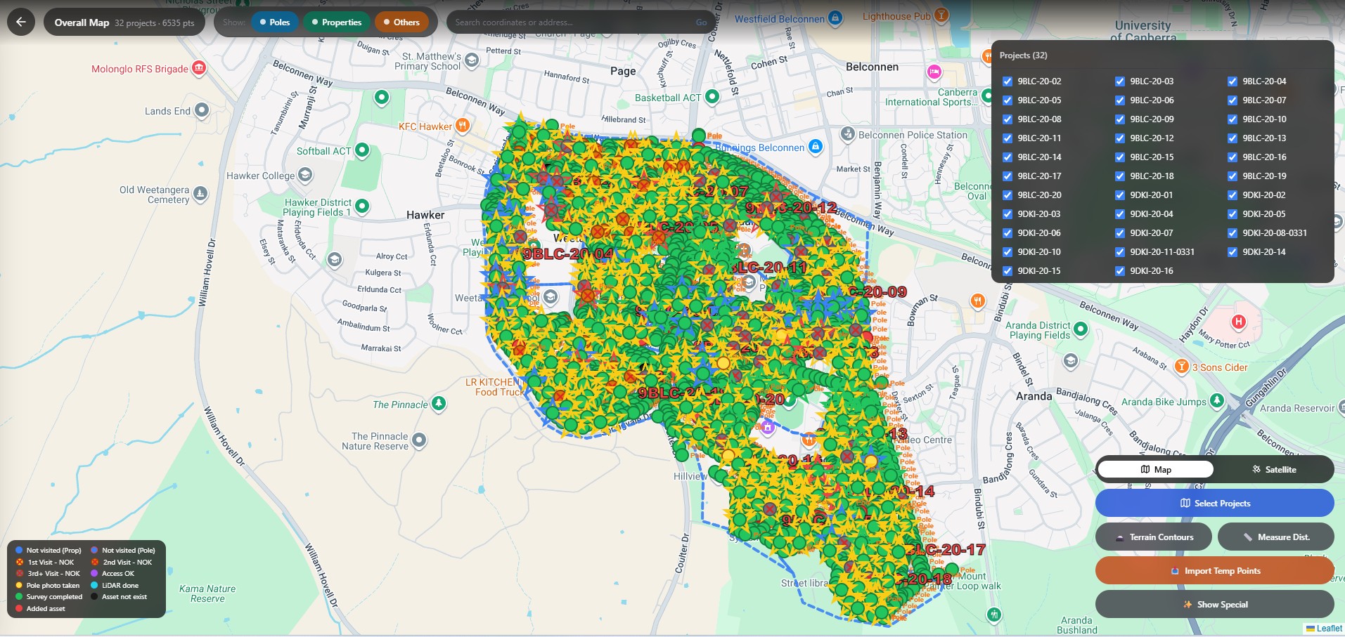
Centralised data repository: All survey data—SLAM point clouds, RTK observations, geotagged photographs, and field notes—were uploaded to a central cloud platform, eliminating the fragmentation and version control issues common in large projects
Real‑time progress tracking: Project managers could monitor the status of each individual asset in real time, identifying gaps, bottlenecks, and quality issues as they arose
Automated quality assurance: The platform included automated checks for data completeness, coordinate consistency, and photographic coverage, reducing manual QA effort
Streamlined deliverable generation: SyncSight automated the assembly of final deliverables—including 3D models, asset registers, and indexed photograph libraries—significantly reducing post‑processing time
Team collaboration: Multiple survey teams, data processors, and project managers could collaborate within a single platform, ensuring everyone worked from the same current data
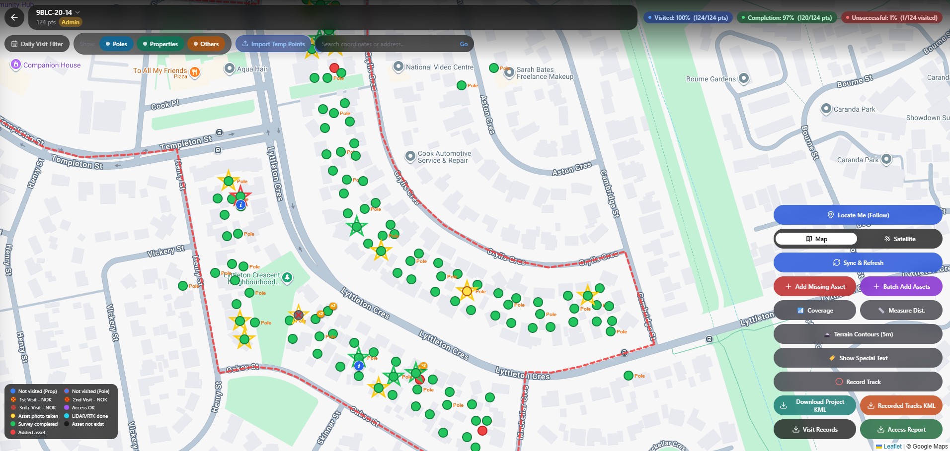
The combination of SLAM LiDAR, RTK rovers, and SyncSight transformed what could have been a logistically overwhelming project into a streamlined, efficiently managed operation.
5. Project Outcomes
5.1 Efficient Asset Capture
The SLAM‑based approach delivered dramatic efficiency gains:
Survey speed: Teams were able to survey rear‑yard assets by saving imore than 40% reduction in field time per asset comparing to the traditional surveying methods
Reduced revisits: The ability to confirm data quality in the field, combined with SyncSight’s real‑time completeness tracking, minimised the need for return visits to properties
Higher daily throughput: Each survey team could complete 20‑30 pole and premises surveys per day, compared to 8‑10 using traditional methods
Accelerated overall timeline: The project was completed significantly faster than would have been possible with conventional surveying technology
5.2 Comprehensive 3D Utility Models
The combination of SLAM LiDAR point clouds and RTK‑grade georeferencing enabled the delivery of:
High‑density 3D models of each utility pole, including accurate representation of pole dimensions, lean, attachments, and surrounding infrastructure
Premises connection records documenting cable routes, termination points, and current connection status for over 4,000 properties
Geospatially accurate data suitable for direct integration into NBN’s design and engineering platforms
Rich photographic documentation indexed and geotagged for easy reference during the design phase
These deliverables provided NBN’s designers with the precise, reliable data needed to plan efficient FTTP upgrade routes—from the street network to each individual premises.
5.3 Enhanced Data Management
SyncSight’s integrated platform delivered significant data management benefits:
Single source of truth: All project data was centralised, eliminating the confusion of multiple file versions and disparate storage locations
Rapid issue identification: Real‑time progress tracking allowed project managers to identify and address gaps or quality issues before they became critical
Faster deliverable production: Automated QA and deliverable generation reduced post‑processing time by an estimated 40‑50%
Improved client confidence: The ability to provide real‑time progress updates and immediate access to verified data strengthened client relationships with Ventia and ServiceStream
5.4 Client Satisfaction
The project was delivered to the complete satisfaction of all stakeholders—Ventia, ServiceStream, and NBN Co. Key feedback included:
On‑time delivery: The project was completed within the agreed timeline, despite the significant access challenges
Data quality: The precision and completeness of the delivered 3D models exceeded client expectations
Professional execution: The LiDAR Solutions team’s professionalism, particularly in managing resident interactions for rear‑yard access, was highly commended
6. Conclusion
The 9BLC-20 and 9DKI-20 NBN SAM projects in Canberra represent a compelling demonstration of LiDAR Solutions’ capability to execute complex, high‑volume surveying assignments for Australia’s most demanding infrastructure programs.
By deploying handheld SLAM LiDAR scanners to overcome rear‑yard access constraints, laser‑equipped RTK rovers for precise georeferencing, and the proprietary SyncSight platform for end‑to‑end data management, LiDAR Solutions transformed a logistically challenging project into a streamlined success. The 70‑85% reduction in per‑asset survey time, combined with accelerated post‑processing and deliverable generation, enabled the project to be completed on schedule and to the highest quality standards.
This project confirms LiDAR Solutions’ position as a trusted partner for tier‑one telecommunications contractors and infrastructure owners. Our ability to combine cutting‑edge technology with robust project management processes ensures we can deliver accurate, reliable, and actionable spatial data—even under the most challenging field conditions.
As NBN Co continues its Fibre Connect rollout and other national infrastructure programs gather pace, LiDAR Solutions stands ready to bring the same innovation, efficiency, and quality to projects of any scale, anywhere in Australia and New Zealand.