
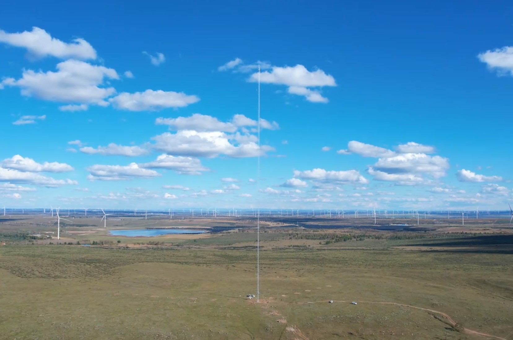
Accurate Wind Measurement and Atmospheric Monitoring with Lidar & Met-mast Technology
What is Wind liDAR?
Wind lidar, also known as wind monitoring lidar or laser wind sensing, is a remote sensing device that measures wind speed and direction using optical sensing techniques. This technology has transformed the way we monitor and analyse atmospheric conditions, delivering precise and dependable data for a wide range of applications.
Wind lidar has the ability to produce detailed measurements of wind speed and direction at various elevations, which is one of its key advantages. Wind speed detection technologies such as anemometers are confined to measuring at specified heights, whereas wind lidar can offer continuous data across the entire height of the atmosphere. This is especially useful in businesses like wind energy, where understanding wind patterns at different heights is critical for effective power generation.
Another advantage of wind lidar is that it is non-intrusive. Wind lidar can measure wind speed and direction remotely, unlike other technologies that require equipment to be placed directly in the wind flow, making it safer and easier to install and operate. This also enables observations in difficult-to-reach areas, such as offshore wind farms.
Another key application of wind lidar is atmospheric monitoring. Wind lidar can give significant data on the dispersion of pollutants and the spread of wildfires by sensing wind speed and direction. It can also be used to track air masses and forecast weather trends.
Finally, wind lidar is an effective technique for atmospheric monitoring and wind speed detection. Because of its accuracy, non-intrusive nature, and capacity to monitor wind patterns at various heights, it is a crucial component of many industries, including wind energy, aviation, and weather forecasting. As technology advances, we can anticipate progressively more advanced and inventive solutions for atmospheric monitoring and analysis.
Key Features
Bankable: fully classified by DNV-GL against DNV-GL according to IEC61400-12-1 ed2, and verified by Windguard and DTU;
Measuring distance: from 30 to 300m, with 12 configurable heights;
Robust design: State-of-Art design and manufacturing, with IP67 protection which can be deployed in harsh environment;
Complex terrain support: complex wind measurement data re-construction with no extra cost
Can operation in various site condition: proven experiences in sites with high altitude, high/low temperature & heavy rainfall area.
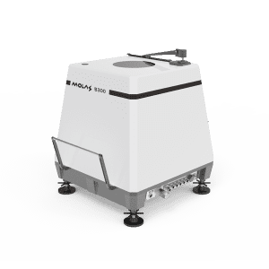
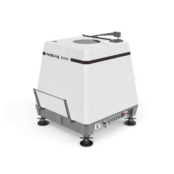
Applications - Molas B300 Onshore Wind Profile LiDAR System
Onshore wind farm development projects:
- Applied after wind farm development feasibility study and before or at micro-siting, to assess wind energy output in specific locations for 3 to 6 month;
Onshore Power Curve Validation:
- Replace the traditional Met-mast to setup at 2.5D away from the wind turbine
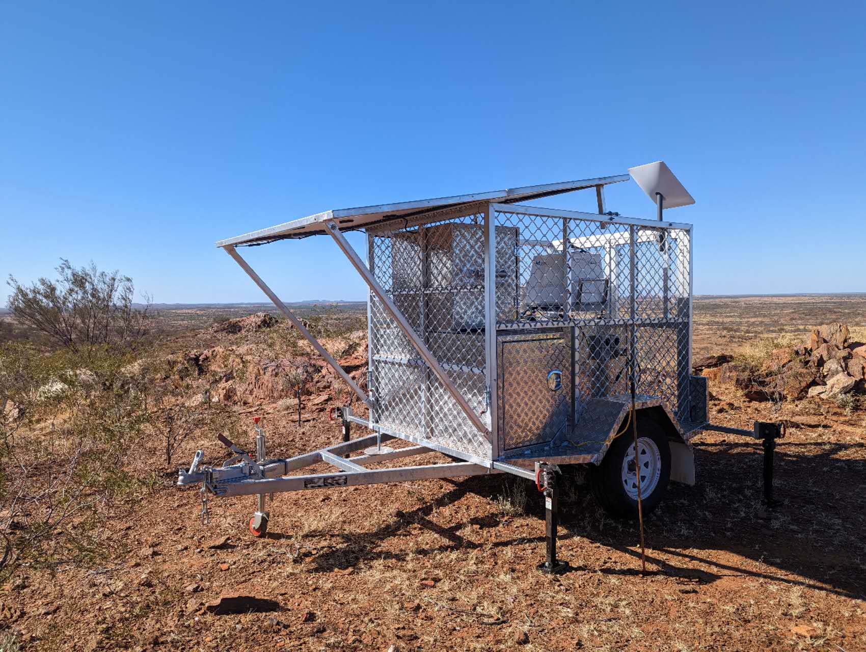
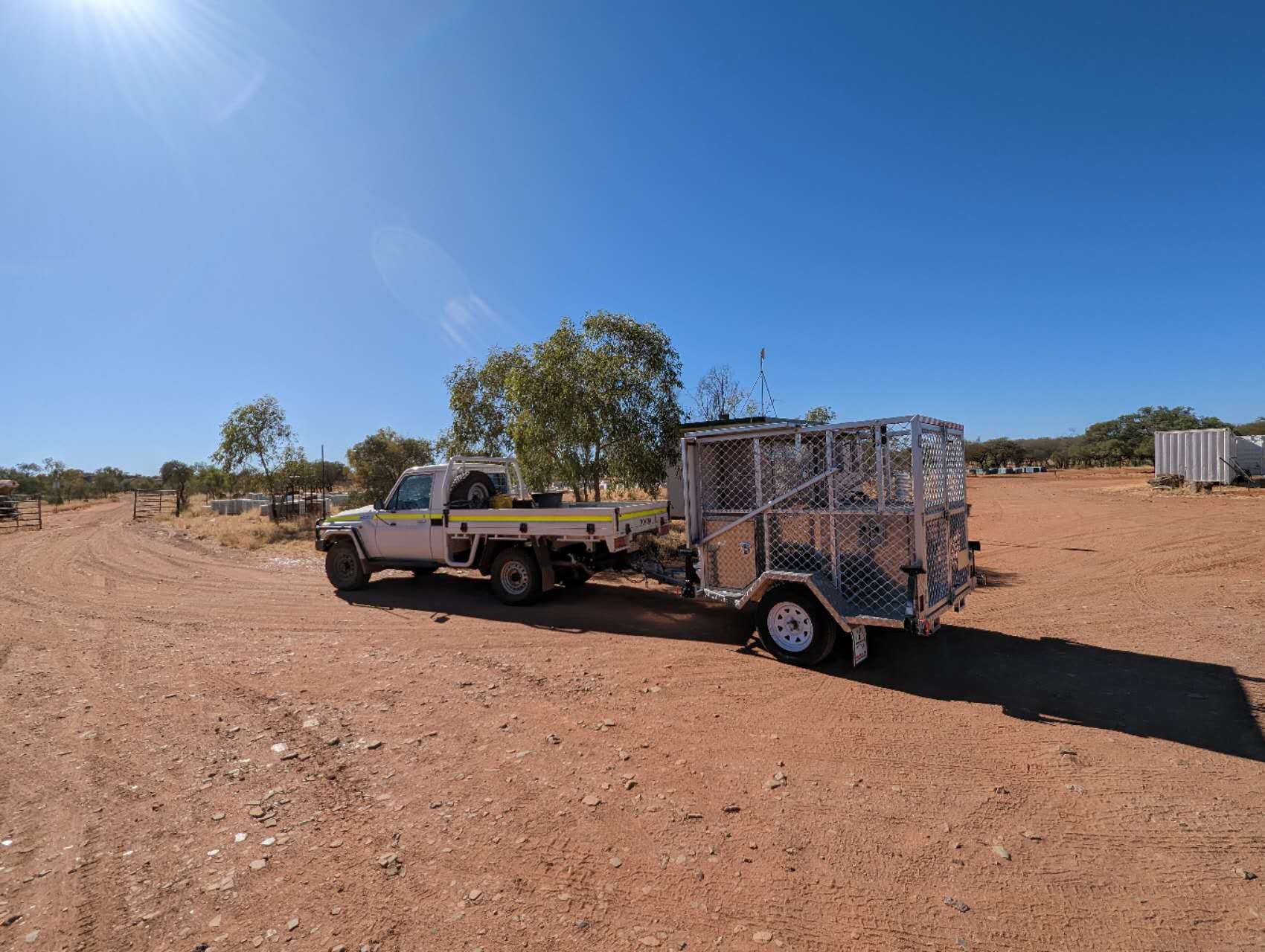
Key Features
All-inclusive: LiDAR, power supply, and communication system are all included
Portable: the whole system can be transported with 4X4 trailer
Easy to Operate: can be setup by 2 technicians within half an hour after the system arrives on site
Great quality: no comprise considered when talk about quality.
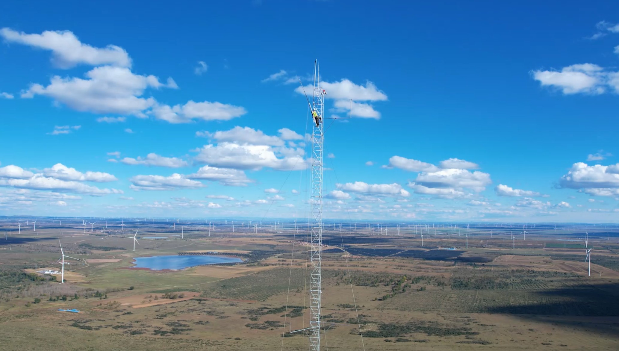
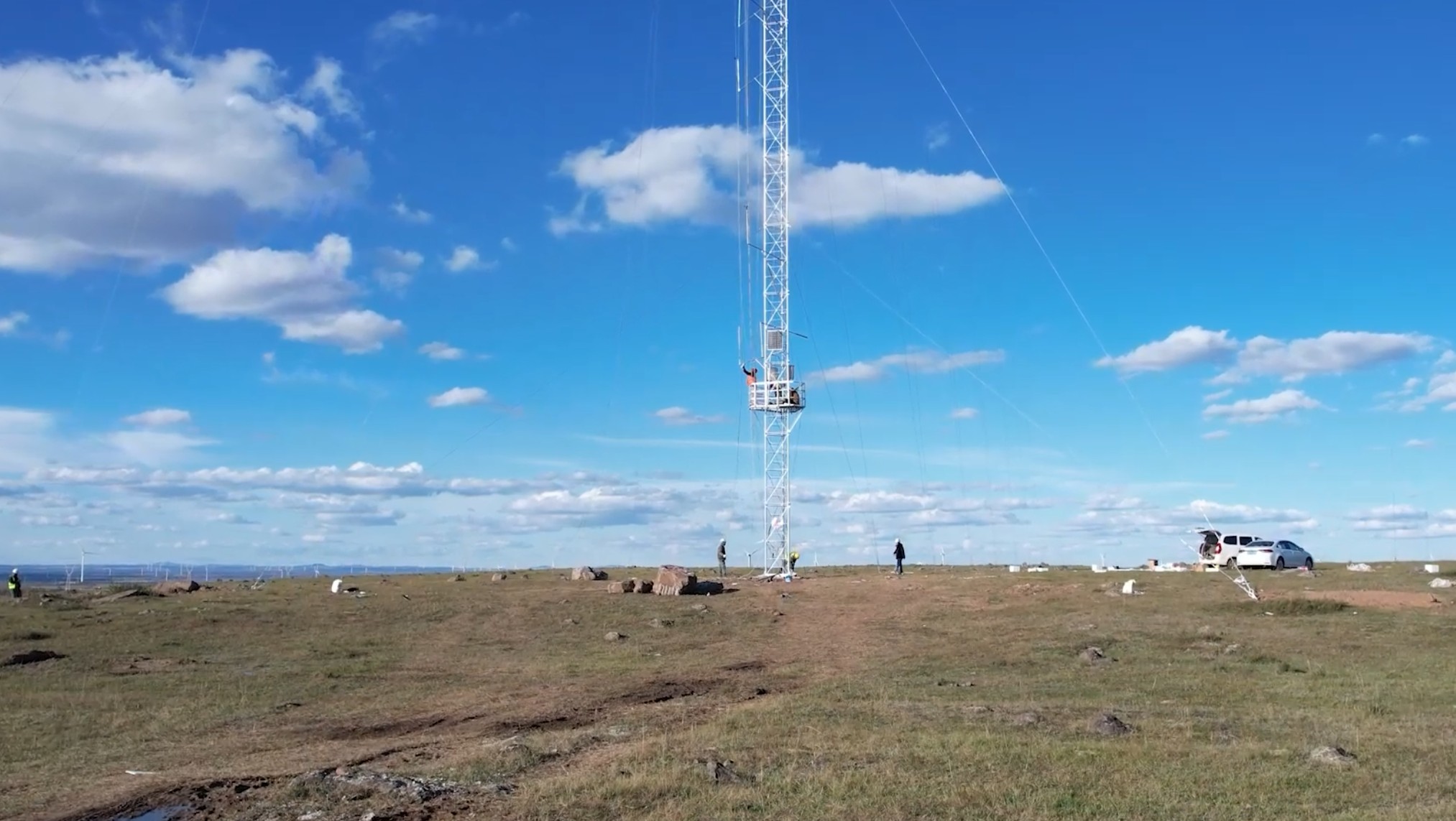
Key Features
60m to 220m Modular Met-Masts: Customizable heights with flexible configuration options
Cup and Sonic Anemometers: Multiple measurement technologies for redundancy and accuracy
Wind Vanes: High-resolution direction sensors with low threshold startup
Temperature, Humidity & Pressure Sensors: Complete meteorological profiling
Data Loggers & Transmission Systems: Real-time wind monitoring with secure cloud access
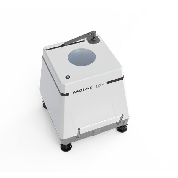
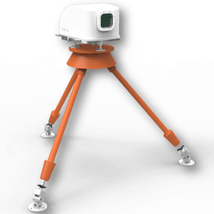
Key Features
Measuring distance: from 30 to 30m, configurable;
Easy to mobilise and setup: smaller dimensions and weight, comparing to the similar lidar products in the market;
High accuracy: Motion attitude correction algorithm secured accuracy ≤ 0.3m/s
Unattended: Satellite data communication and equipment status monitor
Strong robustness: can work stably and continuously under harsh offshore condition
Applications- Molas B300M Wind Monitoring LiDAR
Offshore development projects:
- Applied after wind farm development feasibility study and before or at micro-siting, to assess wind energy output in specific locations for 3 to 6 month;
Offshore power Curve Validation:
- Replace the traditional Met-mast to setup at 2.5D away from the wind turbine
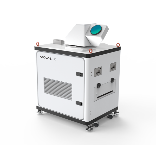
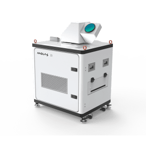
Key Features
Measuring distance: from 45 to 10,000m, configurable;
Easy to mobilise and setup: convenient for installation and transport, it is the lightest scanning wind measurement Lidar with the similar function in the industry;
Easy to access: can be configure with wireless and remote access;
Multi working modes available: Planar Position Indicator (PPI), Range Height Indicator (RHI), Doppler Beam Swinging (DBS) & Spot Scanning mode.
Applications- Molas 3D
Meteorological detection and environmental monitoring
- National & International sports event wind condition measurement;
- Atmospheric pollution diffusion transport and diffusion meteorological conditions monitoring
Civil Aviation Weather
- Aircraft tail vortex measurement
- Airport wind shear detection
Applications in Wind Industry:
- Wind turbine wake measurement
- Wind energy measurement in complex terrain and shear analysis
- Wind farm power control the power according to the measured turbulence and wind turbine wake.
- Micro-siting for complex terrain wind farm
- More adaptable than WAsP to complex terrain.
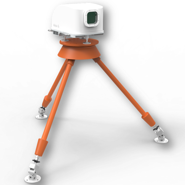
Key Features
Measuring distance: forward-looking from 50 to 400m, configurable;
Cost-effective: under massive production, more than 2,000 units have been deployed
Built-in wind turbine control algorithm:
- Built-in algorithm to measure static wind turbine yaw deviation
- Dynamic wind turbine yaw control
- Wind turbine blades occlusion algorithm (Patent), to increase the data acquisition rate
- Molas NL wind speed prediction algorithm
Designed for high reliability;
Applications
Wind turbine performance optimization:
- Molas NL wind Lidars can be eyes of the modern wind turbines to predict the wind change and then control the pitch and rotor speed to potentially reduce the mechanical fatigue, avoid the extreme load and increase the power output;
Power Curve Validation:
- Molas NL Forward-looking wind measurement Lidar can also be used for power curve validation as the independent wind speed source for the test. This is much more cost-effective than current testing equipment.
Key Features
Measuring distance: typical horizontal detection distance of 6km, with a maximum of 15km, and typical vertical de-tection distance of 9km, with a maximum of 15km;
Fine: fine measurement of 3D aerosol distribution, effective and precise detection within the compartment;
High precision: range resolution of 3m, and temporal resolution of 1s;
Rich detection methods: PPI, CPPI, & RHI scanning, mobile detection, THI detection, etc.;
Diverse measurement settings: minimum range resolution of 3m (adjustable), minimum integration time of 1s (adjustable), and adjustable laser energy;
Flexible data acquisition: multiple data output forms, supporting real-time data output, remote wireless moni-toring and data extraction;
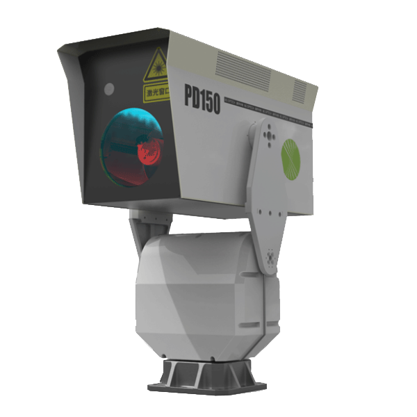
Applications- PD150
Air quality monitoring
- Portable particulate matter lidar has the advantages of wide range, high precision, and stable performance in the air quality monitoring field, making it more suitable for long-term and unmanned monitoring.
- PD150 lidar can use vertical and horizontal scanning observation methods to detect the atmosphere, monitoring the large-scale pollution areas.
Mobile monitoring
- The vehicle-mounted 3D particulate matter lidar can achieve mobile detection on the ground, making it suitable for monitoring air pollution in cities.
- With the advances in technology, the current vehicle-mounted lidar operates in a mobile mode, which involves detecting while moving, and can also perform scanning detection.
Meteorological research:
- Climate effects of aerosols: The impact of aerosols on the Earth-atmosphere system can be divided into direct and indirect effects.
- Environmental effects of aerosols: lidar is the only instrument capable of observing aerosol profiles
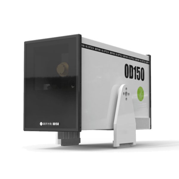
OD150
The 3D ozone lidar OD150 can achieve three-dimensional spatial detection of ozone. The system uses an all-solid-state laser as the light source, adopts the principle of differential absorption, and uses the absorption difference of ozone at different wavelengths to invert the ozone concentration distribution profile along the measurement path. The three-dimensional ozone detection lidar has vertical detection, scanning detection, and navigation detection functions, and is suitable for rapid ozone traceability, short-term forecasting, and emergency monitoring.
RD150
The three-dimensional Raman ozone lidar RD150 can realize three-dimensional spatial detection of ozone and particulate matter. The system uses an all-solid-state laser as the light source and has four detection wavelengths of 280nm, 295nm, 560nm, and 590nm. 280nm and 295nm can be inverted through the principle of ultraviolet differential absorption. Ozone concentration, 560nm and 590nm can invert the particle concentration. The three-dimensional Raman ozone lidar has vertical detection, scanning detection, and navigation detection functions, and is suitable for simultaneous and rapid source tracing of ozone and particulate matter, short-term forecasting, and emergency monitoring.
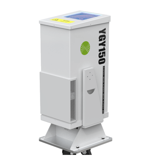
Key Features
The ceilometer YGY150 is based on the backscattering effect of atmospheric aerosol particles (the main component of clouds) on laser light. It emits detection laser pulses. After the meter backscattering of particles in the clouds, the reflected laser light is reflected by the telescope of the ceilometer. After receiving, the backscattering intensity signals at different times (that is, different heights) are obtained; through inversion calculation, the extinction coefficients of each height layer of the atmosphere are obtained, and then the height and thickness of the clouds are determined.
Specs- YGY150
Basic functions: | |
Detection distance (typical value) | more than 15km |
Range resolution | 3m |
Spot diameter | >=10mm |
Temporal resolution | 1s |
Laser wavelength | 532nm |
Pulse energy | 500uJ |
Repetition frequency | 2kHz~7kHz, adjustable |
Power consumption | 200W |
Dimension | 580mm*254mm*335mm |
Weight | <30kg |
Operating temperature range | -20~+50℃ |
FAQ about wind LiDARs
Wind LiDAR (Light Detection and Ranging) is a technology used to measure the wind’s speed and direction. Here’s how it works:
Emission of Light Pulses: Light pulses, usually in the form of laser beams, are released into the atmosphere by the LiDAR system. These pulses are released at regular intervals and are frequently in the infrared range.
Scattering of Light: These light pulses scatter off airborne particles such as dust, aerosols, and water vapor as they move through the atmosphere. Because it bounces some of the light back towards the LiDAR system, this scattering is essential.
Doppler Shift Detection: To find the Doppler shift, the dispersed light that re-enters the LiDAR system is examined. The Doppler shift is a variation in light frequency brought on by airborne particle motion. The light’s frequency slightly shifts when the wind blows these particles about.
Calculating Wind Speed and Direction: The LiDAR measures the Doppler shift in the light that is returned, which allows it to determine the particle velocity and, consequently, the wind speed. The angle at which light is scattered back and the LiDAR system’s orientation define the wind direction.
Data Analysis and Representation: After processing, the LiDAR system’s data is used to create a profile of the wind’s direction and speed at different elevations above the ground. Applications such as weather forecasting, research, and wind farm optimization can benefit greatly from this.
Advantages Over Traditional Methods: LiDAR technology can give data over a greater vertical and horizontal region than traditional anemometers, which detect wind at a single spot. This makes it possible to comprehend wind patterns at various elevations and locations more thoroughly.
To sum up, wind LiDAR systems use laser light to measure the Doppler shift brought on by air particles in motion. This measurement enables precise wind direction and speed determination at different altitudes. In the fields of meteorology, aviation, and renewable energy, this technology has grown in significance.
- Principle: LiDAR uses light, SODAR uses sound.
- Range and Altitude: LiDAR is effective at higher altitudes, while SODAR is more limited in range.
- Weather Impact: LiDAR can be affected by atmospheric conditions that affect light transmission; SODAR is more robust in this aspect but can be influenced by ambient noise.
- Cost and Maintenance: LiDAR is more expensive and complex, SODAR is more cost-effective and simpler to maintain.
- Application Suitability: LiDAR is preferable for high-accuracy, high-altitude applications, whereas SODAR is suitable for lower altitude and less demanding applications.
LiDAR price varies subject to installation method, detection range, and scanning type.
For example, for nacelle LiDAR, it is relatively cheaper as it is under mass production and some wind turbine OEMs start to use nacelle wind LiDAR as standard configuration for their wind turbines. They normally range from 50k AUD up to 100k AUD depends range and number of laser beams.
While for 3D scanning LiDAR, it is much more expensive as its long detection range and scanning opearetion needs more complex mechanism to support. The 3D Scanning wind LiDAR can go up to 500k AUD depending on the configuration.
Please contact our wind LiDAR expert to for a quote and find the most suitable wind LiDAR equipment for wind energy, civil aviation and atomopheric monitoring projects.