
What is LiDAR and how does it work?
Table of Contents
What is LiDAR? And what does LiDAR stand for?
LiDAR stands for Light Detection and Ranging. It is a remote sensing technique that measures distances and creates precise three-dimensional maps of the environment using laser light.
The method works by directing laser beams at a target and then measuring the time it takes for each beam to return to the sensor. A LiDAR system can generate accurate and precise three-dimensional representations of the target by estimating the distance travelled by each laser beam.
How does LiDAR work? Different LiDAR working principle
Time of Flight
The principle of ranging is currently mainly based on the time of flight (time of flight) method, which uses the time interval between the pulse signal emitted by the transmitter and the reflected pulse signal received by the receiver to calculate the distance to the target object. Please find the indication of Time of Flight principle for details.
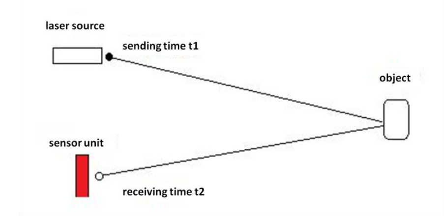
Distance = Speed of Light*(t2 – t1)/2
Time of Flight LiDAR is mainly used for perception unit for autonomous driving, robotics, V2X and surveying application. Learn more details >>.
FMCW - Frequency Modulated Continuous Wave
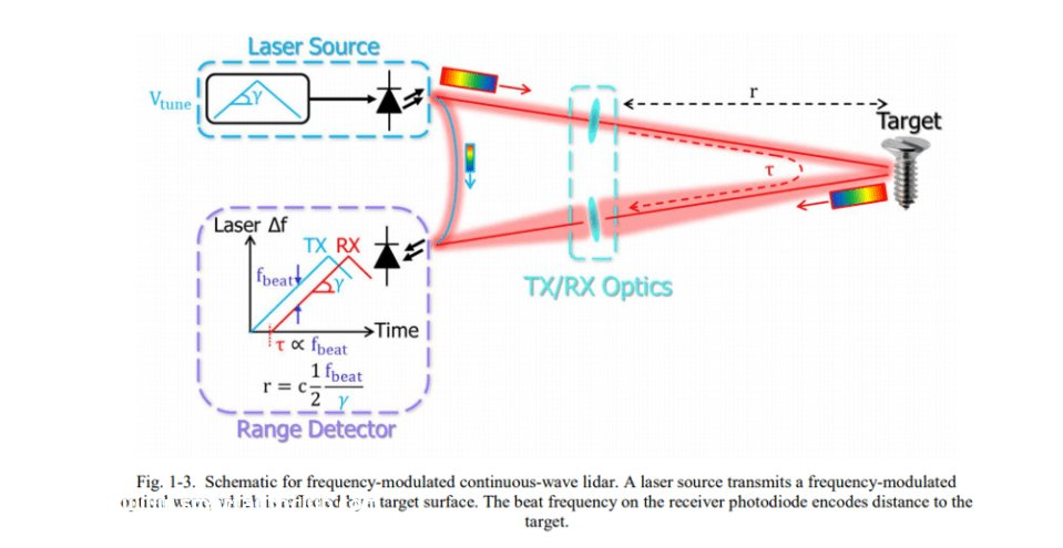
Taking triangular wave frequency modulated continuous wave as an example to introduce its ranging/speed measurement principle. Blue is the frequency of the transmitted signal, red is the frequency of the received signal. The emitted laser beam is repeatedly modulated, and the signal frequency is constantly changing. The laser beam hits an obstacle and is reflected. The reflection affects the frequency of the light. When the reflected light returns to the detector, compared with the frequency when it was emitted, the difference between the two frequencies can be measured, which is proportional to the distance. Calculate the position information of the object. The frequency of FMCW’s reflected light changes according to the speed of the moving object in front. Combined with the Doppler effect, the speed of the target can be calculated.
AMCW - Amplitude-Modulated Continuous-Wave
Amplitude-modulated continuous-wave (AMCW) lidars are similar to basic time-of-flight systems in that AMCW lidars emit a signal and measure the time it takes for the laser light to reflect back. But the difference is that time-of-flight systems emit only one pulse, while AM CW LiDAR achieves modulation by changing the pole current in the laser diode to adjust the intensity of the emitted light.
Triangular LiDAR
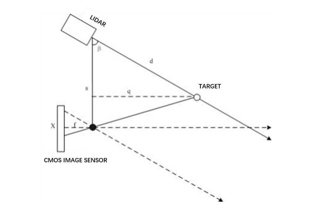
During each ranging, the LiDAR’s pulse modulated laser emits an infrared laser signal, which generates a reflected light spot after irradiating the target object. The light spot is received by the LiDAR’s image acquisition and processing system after passing through a set of optical lenses and is then solved in real time by the LiDAR’s embedded signal processing module. The distance between the target object and the LiDAR and the relative azimuth values are output from the communication interface.
Doppler LiDAR
Doppler LiDAR (Light Detection and Ranging) is a sophisticated technology that measures the speed and direction of objects by using the Doppler effect applied to light waves, typically lasers. Here’s how it works:
Emission of Light: Doppler LiDAR systems emit laser light towards a target. This light is usually in the infrared spectrum and is invisible to the naked eye.
Reflection and Return: The light pulses bounce off particles (like dust, moisture, or other atmospheric constituents) or objects and return to the LiDAR system. The time taken for the light to return is measured to calculate the distance of the object.
Frequency Shift: When the light wave bounces off a moving object, its frequency changes. This phenomenon is known as the Doppler effect. If the object is moving towards the LiDAR system, the frequency of the reflected light increases (shifts to blue). If the object is moving away, the frequency decreases (shifts to red).
Speed and Direction Calculation: By analyzing the change in frequency (or wavelength) of the returned light, the LiDAR system can calculate the speed and direction of the object relative to the LiDAR’s position.
Data Processing: The processed data can provide detailed information about the speed and movement of objects or particles in the atmosphere. This information is essential for applications like meteorology (to study wind patterns), autonomous vehicles (for obstacle detection and navigation), and aircraft navigation systems.
What can we use LiDAR and its data for?
how is lidar data collected?
LiDAR (Light Detection and Ranging) data is collected using a process that involves emitting light pulses and measuring the time it takes for them to return after hitting an object or surface. This technology is often used to create detailed three-dimensional information about the shape of the Earth and its surface characteristics.
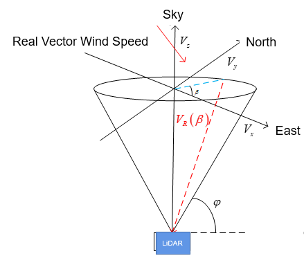
Some LiDARs, like wind measurement LiDARs use Doppler Effect to measure the moving speed of the aersols in the air to measurement wind speed for renewable and atomospheric monitoring projects.
LiDAR data can be applied across different industries and fields.
Autonomous Vehicles
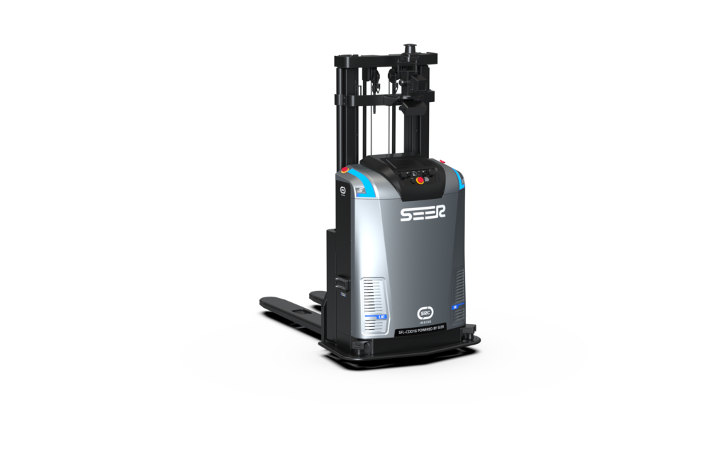
LiDAR systems are crucial for autonomous vehicles, as they provide precise information about the vehicle’s surroundings. The data gathered by LiDAR helps self-driving cars detect obstacles, navigate safely, and make informed decisions on the road, such as Automated Forklift or AGV.
Mapping and Surveying
LiDAR is commonly used for topographic mapping and surveying. It provides highly accurate and detailed elevation data, which is valuable for creating maps of land surfaces, including forests, wetlands, and urban areas.
Forestry and Agriculture
In forestry, LiDAR helps measure forest biomass, canopy structure, and tree height, aiding in forest management and conservation efforts. In agriculture, LiDAR helps monitor crop health, optimize irrigation, and assess land suitability for farming.
Energy Sector
In the energy sector, LiDAR is used to assess the potential of wind and solar energy projects. It helps in the planning and design of wind farms and solar power plants by providing detailed information about the terrain and sunlight availability.
LiDAR can be used for the renewable projects for various purposes, such as:
Onshore wind resource measurement;
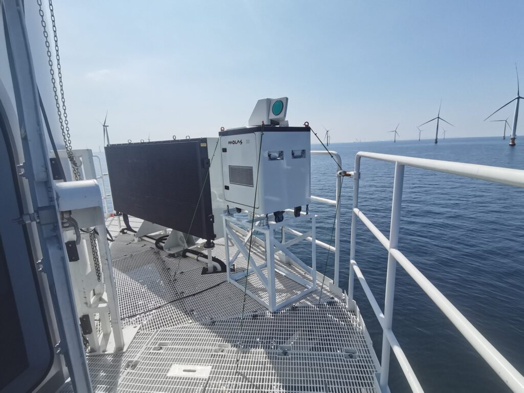
Offshore wind resource measurement;
Wind turbine nacelle mounted LiDAR for power performance test and control optimization;
Civil Aviation
Doppler LiDAR systems are used to measure wind shear around the aircraft glide path and vortex generated by giant aircraft like A380 or B747. This information is critical for air traffic control and pilots, particularly during takeoff and landing.
LiDAR systems can detect and map obstacles like buildings, towers, and natural terrain features around airports. This information is vital for creating obstacle limitation surfaces, which are essential for flight safety.
LiDAR can also be applied for disaster management, archaeology, and environment monitoring.
Disaster Management
LiDAR can be used to assess the impact of natural disasters such as floods, earthquakes, and landslides. It helps in disaster planning and mitigation by providing accurate information about the affected areas.
Archaeology
LiDAR technology is used in archaeology to detect and map ancient structures and landscapes. It helps uncover hidden archaeological sites without the need for extensive excavations.
Environmental Monitoring
LiDAR is used to monitor environmental changes, such as deforestation, erosion, and changes in land cover. It provides valuable data for researchers studying climate change and its impacts on the environment.
Different LiDAR Technology & types
Lidar is a system that integrates three technologies: laser, global positioning system (GPS), and IMU (inertial measurement unit). Compared with ordinary radar, lidar has higher resolution, better concealment, and stronger anti-interference ability. Advantage. With the continuous development of science and technology, the application of lidar is becoming more and more widespread. It can be seen in fields such as robots, driverless cars, and unmanned vehicles. If there is demand, there will be a market. As the demand for lidar continues to grow, As the number of laser radars increases, the types of laser radars have also become dazzling. Lidars can be divided into different types according to their use functions, detection methods, load platforms, etc.
LiDARs classified by functions
Ranging LiDAR Techology
Ranging LiDAR determines the distance between the measured object and the test point by emitting a laser beam to the measured object, receiving the reflected wave of the laser beam, and recording the time difference. Traditionally, lidar can be used in the field of industrial security detection, such as the laser walls seen in science fiction movies. When someone breaks in, the system will respond immediately and issue an early warning. In addition, laser ranging LiDAR is also widely used in the field of surveying and mapping. However, with the rise of the artificial intelligence industry, laser ranging radar has become an indispensable core component of the robot. When used with SLAM technology, it can help the robot perform real-time positioning and navigation and achieve autonomous walking.
Laser speed measurement LiDAR technology
Laser speed LiDAR measures the moving speed of an object. By performing two laser ranging measurements on the measured object with a specific time interval, the moving speed of the measured object is obtained.
There are two main categories of lidar speed measurement methods. One is based on the principle of lidar ranging, that is, the target distance is continuously measured at a certain time interval, and the target distance can be known by dividing the difference between the two target distances by the time interval. The speed value and the direction of the speed can be determined based on the positive or negative value of the distance difference. This method has a simple system structure and limited measurement accuracy, and can only be used for hard targets with strong reflective lasers.
Another type of speed measurement method uses Doppler frequency shift, and the LiDAR uses this technology is call doppler LiDAR. Doppler frequency shift means that when there is a relative speed between the target and the lidar, there will be a frequency difference between the frequency of the received echo signal and the frequency of the transmitted signal. This frequency difference is the Doppler frequency shift. This technology is widely used for wind and atomospheric monitoring LiDARs.
Imaging LiDAR
Laser imaging radar can be used to detect and track targets, obtain target orientation and speed information, etc. It can complete tasks that ordinary radar cannot complete, such as detecting submarines, mines, hidden military targets, etc. It is widely used in military, aerospace, industrial and medical fields.
Atmospheric detection liDAR
Atmospheric detection LiDAR is mainly used to detect molecules in the atmosphere, the density of smoke, temperature, wind speed, wind direction and the concentration of water vapor in the atmosphere, in order to monitor the atmospheric environment and forecast disastrous weather such as storms and sandstorms.
Tracking LiDAR
Tracking LiDAR can continuously track a target, measure the coordinates of the target, and provide the target’s movement trajectory. It is not only used in artillery control, missile guidance, external ballistic measurement, satellite tracking, penetration technology research, etc., but also in the fields of meteorology, transportation, scientific research and other fields.
LiDARs classified by work mediums
Solid LiDAR
The peak power of solid-state lidar is high, the output wavelength range matches existing optical components and devices, and the long output range matches existing optical components and devices (such as modulators, isolators and detectors) and atmospheric transmission characteristics, etc., and The ease of implementing a master oscillator-power amplifier (MOPA) structure, coupled with conductors such as high efficiency, small size, light weight, high reliability and good stability, has given priority to solid-state lidar applications in airborne and space-based systems. In recent years, the focus of lidar development has been diode-pumped solid-state lidar.
Gas LiDAR
Gas lidar is represented by CO2 lidar. It works in the infrared band, has small atmospheric transmission attenuation and long detection range. It has played a great role in atmospheric wind field and environmental monitoring. However, it is large in size and uses mid-infrared HgCdTe detection. The device must work at a temperature of 77K, which limits the development of gas lidar.
Semiconductor LiDAR
Semiconductor lidar can work continuously at a high repetition rate. It has the advantages of long life, small size, low cost and little damage to the human eye. It is widely used in Mie scattering measurements where the backscattering signal is relatively strong, such as detecting cloud base height. Potential applications of semiconductor lidar are measuring visibility, obtaining aerosol extinction profiles in the atmospheric boundary layer and identifying rain and snow, etc. It can be easily made into airborne equipment. Currently, the CT25K laser cloud meter developed by Finland’s Vaisala Company is a typical representative of semiconductor cloud measurement lidar, and its cloud base height measurement range can reach 7500m.
LiDARs classified by Number of Lines
Single line LiDAR or 2D LiDAR scanner
Single-line lidar or 2D LiDAR scanner is mainly used to avoid obstacles. It has fast scanning speed, strong resolution and high reliability. Since single-line lidar reflects faster in angular frequency and sensitivity than multi-line and 3D lidar, it is more accurate in testing the distance and accuracy of surrounding obstacles. However, single-line LiDAR can only scan in a plane manner and cannot measure the height of objects, which has certain limitations. Currently it is mainly used in service robots, such as our common sweeping robots.
Multi line LiDAR or 3D LiDAR scanner
Multi-line lidar, or 3D LiDAR scanner, is mainly used for automotive, robotics, or surveying LiDAR imaging. Compared with single-line lidar, it has made qualitative changes in dimensionality improvement and scene restoration, and can identify the height information of objects. Multi-line lidar is conventionally 2.5D and can be 3D. Currently, the main ones launched in the market are 16-line, 32-line, 128-line,or even more. But the price of the 3D LiDAR sensors has significantly dropped as well.
LiDARs classified by scanning methods
LiDAR classifications are diverse, and this article will introduce the classification of LiDARs according to scanning methods.
Mechanical LiDAR Technology
The transmitting and receiving modules of the mechanical rotating Lidar rotate in a macro sense. Multiple groups of laser line beams are arranged in the vertical direction. The transmitting module emits laser lines at a certain frequency, and dynamic scanning is achieved by continuously rotating the transmitting head.
Mechanically rotating Lidar’s discrete transceiver components requires manual optical path alignment during the production process, which is time-consuming and labor-intensive, and has poor mass production. At present, some mechanical rotating lidar manufacturers have taken the chip route, integrating multi-line laser emitting modules into one chip to improve production efficiency and mass production, reduce costs, reduce the size and volume of rotating parts, and make it easier to process automotive regulations.
Pros of Mechanical LiDAR
- Technology is mature
- Fast scanning
- 360 degree scan
Cons of Mechanical LiDAR
- Poor mass production: complex optical path debugging and assembly, low production efficiency
- Expensive: By increasing the number of transceiver modules to achieve a high scanning channels, the cost of components is high.
- Difficulty with automotive standard regulations: The rotating parts are large in size/weight and difficult to meet the stringent requirements of automotive standard regulations.
- The shape is not easy to integrate into the car body
Hybrid Solid State LiDAR scanner
Hybrid solid-state lidar uses “micro-moving” devices to replace macro-mechanical scanners to achieve laser scanning at the LiDAR transmitter on a microscopic scale. The reduction in rotation amplitude and volume can effectively improve system reliability and reduce costs.
MEMS LiDAR scanner
What is MEMS LiDAR scanner? What does MEMS stand for?
MEMS stands for MicroElectroMechanical Systems. LiDAR that uses MEMS mirror-based scanning technology is called MEMS LiDAR, which has unique benefits over other types of laser scanners in terms of size, speed, and cost, making them perfect for LiDAR in a wide range of applications.
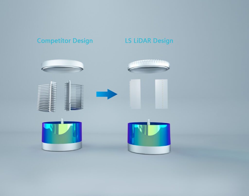
MEMS galvanometer is a silicon-based semiconductor component, which is a solid-state electronic component. It integrates a very compact micro-galvanometer on a silicon-based chip. Its core structure is a very small cantilever beam – the mirror is suspended on the A pair of torsion bars on the front, back and left oscillate at a certain harmonic frequency, and the rotating micro-mirrors reflect the laser light to achieve scanning. The silicon-based MEMS micromirror has good controllability and can achieve fast scanning. Its equivalent line beam can be as high as one to two hundred lines. Therefore, when the same point cloud density is required, the number of laser emitters of the silicon-based MEMS Lidar is lower than that of the mechanical rotating one, with smaller dimensions and high reliability as well.
Pros of MEMS LiDAR
MEMS micro-vibration mirrors get rid of mechanical motion devices such as bulky motors and multiple transmitting/receiving modules. Millimeter-sized micro-vibration mirrors greatly reduce the size of lidar and improve stability.
MEMS micro-mirrors can reduce the number of laser emitters and detectors, greatly reducing costs
Cons of MEMS LiDAR
The limited optical aperture and scanning angle limit Lidar’s ranging capabilities and FOV. A large field of view requires multi-subfield splicing, which requires high point cloud splicing algorithms and point cloud stability.
Impact and vibration resistance is questionable at the stage
Rotating scanning mirror LiDAR scanner
As the first mass-produced L3 level autonomous passenger car, the lidar equipped on the Audi A8 is a rotating scanning mirror lidar. Unlike mechanical rotating lidar, its laser transmitting module and receiving module are stationary, and only the scanning mirror is mechanically rotating. The laser unit emits laser light to the rotating scanning mirror (Mirror), which is deflected forward (scanning angle 145°). The light reflected by the object is received by the detector on the lower left through the optical system.
Pros of Rotating scanning mirror LiDAR scanner
Can be used in cars, long life, high reliability
Cons of Rotating scanning mirror LiDAR scanner
The number of scanning lines is small and the scanning angle cannot reach 360 degrees.
wedge prism rotation LiDAR
The PLD (Pulsed Laser Diode) of the transceiver module emits laser light, which becomes parallel light through the reflector and convex lens. The two rotating prisms of the scanning module change the optical path so that the laser light is emitted from a certain angle. The laser hits the object, returns from the original optical path after reflection, and is received by the APD.
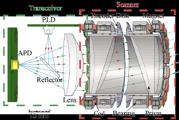
Compared with MEMS Lidar, it can achieve a large clear aperture and can measure a longer distance. Compared with mechanical rotating Lidar, it greatly reduces the number of laser emission and reception lines, reduces the complexity of focusing and calibration, greatly improves production efficiency, and reduces costs.
Pros of wedge prism rotation LiDAR
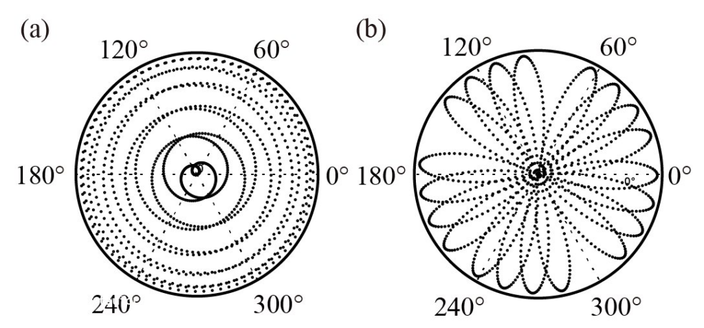
Non-repetitive scanning solves the problem of missed objects caused by line scanning of mechanical lidar
Achieving nearly 100% field of view coverage as scanning time increases
There is no rotational wear of electronic components, higher reliability, and complies with vehicle regulations.
Cons of wedge prism rotation LiDAR
The FOV of a single radar is small, and the field of view coverage depends on the integration time
The unique scanning method makes its point cloud distribution different from traditional mechanical rotating Lidar, which requires algorithm adaptation.
Solid State LiDAR scanner
Flash LiDAR
Flash lidar adopts a working mode similar to that of Camera, but the photosensitive element is different from that of ordinary cameras. Each pixel can record the flight time of photons. Since the object has three-dimensional spatial properties, the light that strikes different parts of the object has different flight times and is detected by the focal plane detector array and output as a “three-dimensional” image with depth information. According to different laser light sources, Flash lidar can be divided into pulse type and continuous type. The pulse type can achieve long-distance detection (more than 100 meters), and the continuous type is mainly used for short-range detection (tens of meters).
The advantage of Flash lidar is that it can quickly record the entire scene, avoiding errors caused by the movement of the target or the lidar itself during the scanning process. Its disadvantage is that the detection distance is short.
Transmitting module: Flash lidar uses a vertical cavity surface emitting laser (VCSEL), which is smaller, lighter, more durable, faster, easier to manufacture, and more power efficient than other lasers.
Receiving module: The performance of Flash lidar mainly depends on the sensitivity of the focal plane detector array. The focal plane detector array can use a PIN type photodetector, add a lens unit to the front end of the detector and use a high-performance readout circuit to achieve short-distance detection. For long-distance detection requirements, avalanche photoelectric detectors need to be used, which have high detection sensitivity and can achieve single-photon detection. APD-based area array detectors have the advantages of long-distance single-frame imaging and easy miniaturization.
Pros Flash LiDAR
Realize global imaging at one time to complete detection without considering motion compensation
No scanning device, fast imaging speed
High integration and small size
Chip-level process, suitable for mass production
All solid-state advantages, easy to pass vehicle regulations
Cons of flash LiDAR
Laser power is limited and detection distance is short
Poor anti-interference ability
Low angular resolution
Optical Phased Array LiDAR (OPA) LiDAR
Many military Lidars use OPA (Optical Phased Array) optical phased array technology. OPA uses the principle of coherence, uses multiple light sources to form an array, and controls the direction of the output laser beam by adjusting the phase difference of each emission unit in the emission array. The OPA lidar completely controls the scanning direction by electrical signals. It can dynamically adjust the scanning angle range and perform global scanning of the target area or local fine-grained scanning of a certain area. One lidar may cover near/medium/long-distance targets. detection.
Pros of OPA LiDAR
Pure solid-state lidar, small in size and easy to measure for vehicles
The scanning speed is fast (generally reaching the MHz level or above)
High accuracy (can reach μrad level or above)
Good controllability (high-density scanning can be performed on the target area of interest)
Cons of flash LiDAR
It is easy to form side lobes, which affects the beam distance and angular resolution, causing the laser energy to be dispersed.
High processing difficulty: Optical phased array requires that the size of the array unit must not be larger than half a wavelengt
The detection distance is difficult to achieve very far
LiDARs classified by laser emission waveform
Continuous wave LiDAR
From the perspective of the principle of laser, continuous laser light always comes out, just like turning on the switch of a flashlight, its light will always be on (except for special circumstances). Continuous laser relies on continuous bright light to the height to be measured to collect data at a certain height. Due to the working characteristics of continuous laser, only one point of data can be collected at a certain time. Because of the uncertain nature of wind data, using one point to represent the wind conditions at a certain height is obviously one-sided. Therefore, some manufacturers’ compromise method is to rotate 360 degrees and collect multiple points on the edge of the circle for average evaluation. Obviously, this is a concept of multi-point statistical data in a virtual plane.
Pulsed LiDAR
The laser output from the pulse laser is discontinuous, but flashes one after another. The principle of pulse laser is to emit tens of thousands of laser particles. According to the internationally accepted Doppler principle, the wind conditions at a certain height are comprehensively evaluated from the reflection of these tens of thousands of laser particles. This is a three-dimensional concept, so Only then does the theory of detection length exist. From the perspective of laser characteristics, pulse laser can measure dozens of times more points than continuous laser, and can more accurately reflect wind conditions at a certain height.
LiDARs classified by load platform
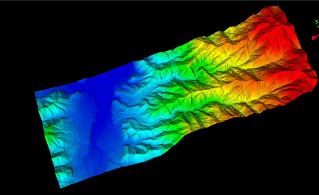
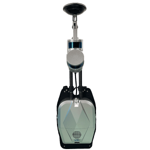
Airborne LiDAR
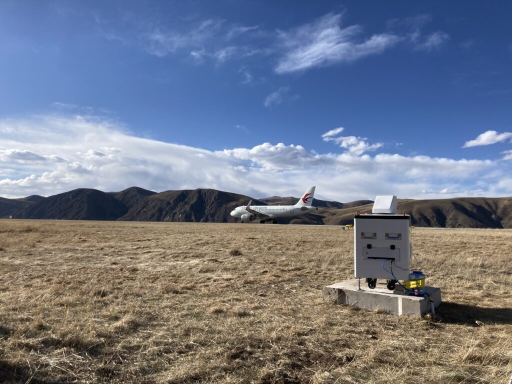
Airborne lidar closely integrates laser ranging equipment, GNSS equipment, INS and other equipment. It uses the flying platform as a carrier to scan the ground and record the attitude, position and reflection intensity of the target to obtain three-dimensional information on the surface. And in-depth processing technology to obtain the required spatial information. It has broad potential and prospects in both military and civilian fields. Airborne lidar has a short detection range. When the laser is transmitted in the atmosphere, the energy is attenuated by the influence of the atmosphere. The range of lidar is within 20 kilometers, especially in harsh weather conditions, such as dense fog, heavy rain, smoke, and dust. The action distance will be greatly shortened, making it difficult to work effectively. Atmospheric turbulence will also reduce the measurement accuracy of lidar to varying degrees.
Example of the Airborne LiDAR:
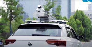
Vehicle-mounted LiDAR
Vehicle-mounted lidar, also known as vehicle-mounted 3D laser scanner, is a mobile 3D laser scanning system that can emit and receive laser beams, analyze the return time after the laser encounters the target object, and calculate the relative distance between the target object and the vehicle. And use the collected three-dimensional coordinates, reflectivity and other information of a large number of dense points on the surface of the target object to quickly reconstruct the three-dimensional model of the target and various map data, establish a three-dimensional point cloud diagram, and draw an environmental map to achieve environmental awareness. Purpose. Vehicle-mounted lidar is playing an increasingly important role in the trend of autonomous driving “car manufacturing”. Companies such as Google, Baidu, BMW, Bosch, Delphi and other companies have all used lidar in their autonomous driving systems, driving the development of vehicle-mounted lidar. The industry expanded rapidly.
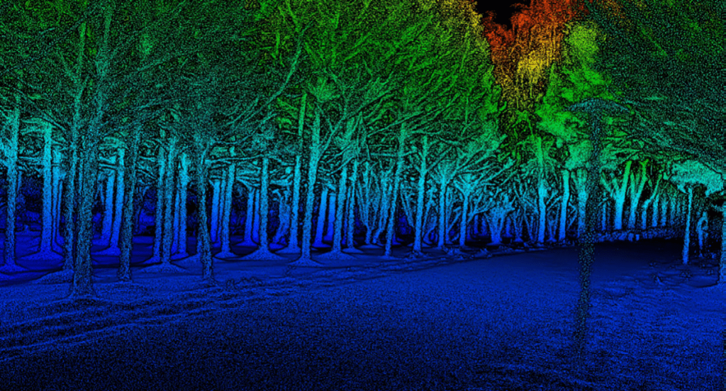
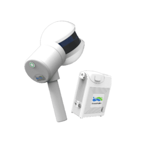
Terrestrial LiDAR
Ground-based lidar can obtain 3D point cloud information in forest areas, and use point cloud information to extract the position and height of individual trees. It not only saves manpower and material resources, but also improves the accuracy of extraction, and has advantages that other remote sensing methods cannot match. Through the analysis of the forestry application of this technology at home and abroad and the verification of the results in the later stages of research on this invention, this technology will be used to extract various forest parameters in a larger research area in the future.
The most popular terrestrial LiDAR systems are backpack and handheld LiDAR system, as they are cost-effective and highly efficient. Learn more:
Spaceborne LiDAR
Spaceborne LiDAR uses a satellite platform with a high orbit and wide observation field of view, and can reach every corner of the world. It provides a new way to obtain three-dimensional control points and digital ground models in overseas areas, which is of great significance for both national defense and scientific research. Spaceborne lidar also has the ability to observe the entire celestial body. Spaceborne lidar is included in the United States’ exploration plans for the moon and Mars, and the data it provides can be used to produce comprehensive three-dimensional topographic maps of celestial bodies. In addition, spaceborne lidar can also play an important role in measuring the vertical distribution of vegetation, measuring sea surface height, measuring the vertical distribution of clouds and aerosols, and monitoring special climate phenomena.
Understanding LiDAR Scans
How LiDAR Scans Work
Light detection and ranging, or LiDAR scanning, is a type of remote sensing that measures distances to Earth by using light in the form of a pulsed laser. This is a thorough description of how LiDAR scanning operates:
Emission of Laser Pulses:
Laser pulses are directed at the target region by the LiDAR system. These lasers can operate in the visible, ultraviolet, or infrared light spectrums.
The target region is covered in a methodical way by the fast-emitting pulses.
Measurement of Travel Time:
The laser pulse returns to the LiDAR sensor after striking the target surface.
Each pulse’s return time is measured by the LiDAR system. Since light travels at a constant speed, the round-trip duration of each laser pulse may be used to determine the distance between the target and the LiDAR sensor.
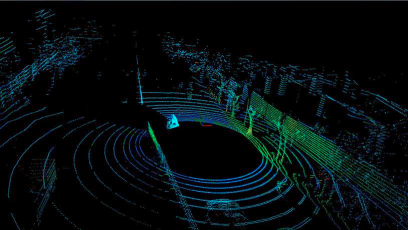
Generation of Point Clouds:
Using the distance information gathered from the laser pulses that return, “point clouds,” or big collections of data points that depict the area scanned, are created.
A three-dimensional representation of the target area is produced by assigning a unique set of coordinates (latitude, longitude, and height) to each point in the cloud.
Processing and Interpretation:
The point cloud data is processed in raw form to eliminate noise and extraneous information.
The point cloud is interpreted using sophisticated software and algorithms, which convert data into formats that may be used, like 3D models or topographic maps.
Integration with GPS and IMU:
The GPS (Global Positioning System) and IMU (Inertial Measurement Unit) are included into the majority of LiDAR systems.
Precise position data is supplied by the GPS, while the IMU monitors the LiDAR system’s orientation and movement—particularly crucial for airborne LiDAR.
The components of LiDAR Scanning System
Several essential parts of a LiDAR (Light Detection and Ranging) scanning system cooperate to collect and process environmental data. These elements, each of which has a distinct purpose in the scanning process, are essential to the LiDAR system’s operation. The following are the principal parts of a LiDAR system:
Laser:
This is the main power source for the LiDAR system, shooting light pulses in the direction of the target region or object, usually in the infrared range. Depending on the application, the laser’s properties, such as wavelength and pulse rate, may change.
Scanner and Optics:
The laser pulses are directed over the survey region by the scanning system. Moreover, it collects the light that is reflected back into the system.
The reflected light and laser beams are focused and directed by the optics, which includes mirrors and lenses.Photodetector and Receiver Electronics:
The sensor that finds the pulses of reflected light is called a photodetector.
The detected light is transformed into electrical impulses by the receiver electronics so that it can be measured and examined.Position and Navigation Systems:
The Global Positioning System, or GPS, is utilized to pinpoint the exact location of the LiDAR system; this is particularly important for aerial LiDAR systems.
GPS and Inertial Measurement Units (IMUs) are frequently used together. It guarantees precise laser data location by giving details about the LiDAR system’s orientation, tilt, and altitude.Data Storage and Processing Unit:
Systems that use onboard memory save captured data.
The raw data is processed into formats that may be used by processing devices, which are usually computers equipped with specialized software. This processing involves producing point clouds or other visual representations and converting the time-of-flight of laser pulses into distance measurements.Power Supply:
Batteries, an electrical connection, or an alternative power source may be used to power a LiDAR system, depending on its design and intended use, particularly for mobile or aerial systems.
Mounting Platform:
The LiDAR system type determines the platform. In terrestrial systems, a tripod could be used. A satellite, drone, or airplane could serve as the platform for airborne systems.
When combined, these elements give the LiDAR system the ability to precisely record and display the physical features of the scanned area in three dimensions. LiDAR systems’ sophistication and capabilities are still developing, making it possible to collect data for a variety of applications that is increasingly exact and detailed.
In the context of LiDAR (Light Detection and Ranging), the term “Doppler effect” refers to the shift in wavelength or frequency of light reflected back to the sensor from a moving object. This phenomena is comparable to the better-known Doppler effect in sound, in which an object’s frequency varies in response to its motion relative to the observer.
The Doppler effect is employed in LiDAR systems to calculate an object’s or surface’s velocity.
Advancements in LiDAR Technology
Recent Innovations in LiDAR
LiDAR (light detection and ranging) technology has advanced significantly in recent years because to the growing need for precise, accurate, and reasonably priced spatial data across a range of industries. Among the most significant recent advancements in LiDAR technology are:
Solid-State LiDAR:
This newer type of LiDAR system does not have moving parts, unlike traditional mechanical LiDAR. Solid-state LiDAR offers advantages in terms of durability, longevity, and size reduction, making it particularly appealing for use in autonomous vehicles and mobile devices.
Miniaturization:
There has been a significant push to reduce the size and increase the compactness of LiDAR units. LiDAR technology may now be incorporated into small-scale applications such as drones and smartphones because to its downsizing.
Increased Resolution and Range:
LiDAR systems with improved resolution and extended range are now possible thanks to developments in laser and sensor technology. These advancements make it possible to gather more precise data over wider regions, which improves applications in urban planning, forestry, and geology.
Cost Reduction:
The expense of LiDAR technology has proven to be one of its main obstacles. The goal of recent developments has been to lower the cost of LiDAR systems, opening up the technology for a wider range of uses.
Integration with AI and Machine Learning:
LiDAR data combined with machine learning and artificial intelligence (AI) algorithms has created new opportunities for data interpretation and analysis. In domains where real-time data processing is essential, such as autonomous driving, this integration has a particularly significant influence.
Flash LiDAR:
Unlike typical LiDAR, which uses numerous pulses to scan an area, flash LiDAR captures the whole field of view in a single pulse. Faster than previous technology, this one can be useful in dynamic settings like city streets and highways.
Photonics and Optoelectronics Advances:
More potent and efficient LiDAR systems have been made possible by advancements in photonics and optoelectronics. These improvements lead to improved performance under difficult lighting circumstances and more accurate detail capture.
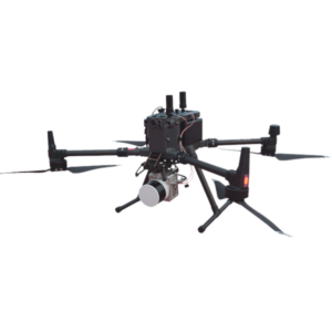
UAV and Drone Integration:
LiDAR has becoming more widely used in remote locations thanks to its integration with drones and unmanned aerial vehicles (UAVs), offering a versatile and effective way to gather data.
Automotive LiDAR:
LiDAR technology for automobiles has advanced quickly with the development of autonomous vehicles. This includes creating more affordable, durable, and compact devices that can be produced in large quantities for the automobile sector.
These developments are a reflection of the dynamic nature of LiDAR technology and its growing application across a range of industries, such as environmental monitoring, urban development, autonomous vehicles, and more. LiDAR systems should continue to improve in terms of versatility, affordability, and precision as technology progresses.
what are the Future Trends in LiDAR technology
Light detection and ranging, or LiDAR technology is expected to make major strides in the future and find greater use in a variety of sectors. The demand for high-precision spatial data is growing, continued technological advancements, and integration with other new technologies are shaping the trends in LiDAR applications. Future trends in LiDAR applications include the following:
Autonomous Vehicles and Advanced Driver-Assistance Systems (ADAS):
- LiDAR, which provides high-resolution, real-time data necessary for navigation and obstacle avoidance, is vital to the development of autonomous vehicles. It is anticipated that future developments will concentrate on improving LiDAR systems’ accuracy, range, and affordability in order to facilitate their wider use in the automobile sector.
Smart Cities and Urban Planning:
- LiDAR’s capacity to enable advanced urban planning will be essential to the creation of smart cities. It may be used to create complex three-dimensional models of urban areas, which will be useful for monitoring the environment, controlling traffic, and building infrastructure.
Integration with 5G and IoT:
- Real-time data gathering and analysis will be made possible by the integration of LiDAR with 5G networks and the Internet of Things (IoT), improving applications in security, surveillance, and smart infrastructure management.
Precision Agriculture:
- It is anticipated that LiDAR technology would proliferate in the agricultural sector, aiding farmers in crop monitoring, land surveying, and precision farming techniques, which will optimize agricultural operations.
Environmental Monitoring and Climate Change Studies:
- The capacity of LiDAR to deliver comprehensive topographical and vegetation data will be utilized more and more in investigating the effects of climate change, monitoring environmental changes, and evaluating biodiversity.
Drone and Unmanned Aerial Vehicle (UAV) Integration:
- It is anticipated that the usage of LiDAR in drones and UAVs for mapping and surveying hazardous or inaccessible locations would increase. Archaeological research, geological surveys, and disaster management will all benefit greatly from this trend.
Advances in Solid-State LiDAR:
- Future developments in solid-state LiDAR technology should result in systems that are more affordable, smaller, and energy-efficient, which will increase its application across a range of industries.
Healthcare and Biomedical Applications:
- There will probably be more advancements in the creative applications of LiDAR in healthcare, including patient monitoring, assistive technology for the blind, and advanced imaging methods.
Augmented Reality (AR) and Virtual Reality (VR):
- By offering precise geographical data for the construction of immersive and interactive environments, LiDAR can improve AR and VR experiences.
Space Exploration:
- LiDAR technology will remain a vital instrument for space exploration, helping with planetary mapping, astronomical body research, and spaceship landing and navigation.
These patterns suggest that LiDAR technology will keep developing and finding its way into our daily lives, changing the way we engage with and perceive the environment. LiDAR is a crucial technology for the future because of its accuracy and versatility; the only restrictions on its possible uses are your imagination.
FAQs about LiDAR
What Is LiDAR?
LiDAR, which stands for Light Detection and Ranging, is a remote sensing technology that uses laser light to measure distances and create detailed 3D representations of objects and environments.
How Does LiDAR Work?
LiDAR works by emitting laser pulses and measuring the time it takes for the light to reflect off objects and return to the sensor. This data is used to calculate distances and create accurate 3D models.
What Are The Applications Of LiDAR?
LiDAR is used in various applications including autonomous vehicles, forestry, agriculture, archaeology, urban planning, environmental monitoring, and more.
How Is LiDAR Used In Autonomous Vehicles?
LiDAR is a crucial sensor in autonomous vehicles, helping them create detailed maps of their surroundings and detect obstacles in real-time for safe navigation.
What Are The Types Of LiDAR Systems?
Survey LiDAR systems:
There are mainly two types of survey LiDAR systems: airborne LiDAR, which is mounted on aircraft for wide-area mapping, and terrestrial LiDAR, which is ground-based and captures detailed data of smaller areas.
Wind LiDAR systems:
Wind LiDAR uses doppler effect to measure the wind speed and direction, which can be applied for renewable, civil aviation and atomospheric monitoring. There are few types of them:
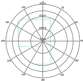
What's The Difference Between 2D And 3D LiDAR?
2D LiDAR only measures distances in a single plane, while 3D LiDAR measures distances in multiple directions, capturing a more comprehensive view of the environment. Here are the point cloud comparison between 2D & 3D LiDAR.
How Accurate Is LiDAR?
LiDAR can provide highly accurate distance measurements, often within a few centimeters. The accuracy depends on factors such as the type of LiDAR system, the quality of the equipment, and environmental conditions.
Most LiDARs use TOF (Time of Flight) measurement, the further the object is, the more accurate is the measurement, as it is more difficult to measure the time of the light travelling in the lower range.
What Is The Range Of LiDAR?
The range of LiDAR can vary depending on the technology and equipment used. It can range from a few meters to several kilometers. Nowadays, most long range LiDARs use 1550nm wavelength light for detection.
What's The Difference Between LiDAR And RADAR?
LiDAR uses laser light, while RADAR uses radio waves. LiDAR typically provides higher resolution and accuracy in detecting objects and capturing details.
Learn more about detailed comparison between LiDAR and RADAR.
Can LiDAR See Through Obstacles Like Walls?
No, LiDAR cannot see through solid obstacles like walls. It relies on the reflection of light, so if an object is obstructed from direct line of sight, LiDAR won’t be able to detect it.
can lidar penetrate water?
LiDAR technology has limited capability in penetrating water. Its effectiveness in penetrating water depends on various factors:
Type of LiDAR: The ability to penetrate water varies depending on the type of LiDAR system. Traditional airborne LiDAR, which uses infrared light, is generally not effective for penetrating water because infrared light is absorbed by water. However, Bathymetric LiDAR, a specific type of LiDAR, is designed for underwater mapping.
Water Clarity: Clearer water allows for deeper penetration by LiDAR pulses. In murky or turbid water, the light pulses are scattered and absorbed more, limiting the depth of penetration.
Wavelength of Light: Bathymetric LiDAR systems often use green light, which can penetrate water better than the infrared light used in traditional LiDAR. The green light can reach and reflect off the sea floor in relatively clear and shallow waters, enabling the mapping of marine environments.
Water Depth: Even with bathymetric LiDAR, there is a limit to the depth that can be effectively mapped. Very deep waters are beyond the reach of current LiDAR technology.
Environmental Conditions: Factors such as the presence of suspended particles, algae, or other substances in the water can affect LiDAR’s ability to penetrate it.
In summary, while standard LiDAR systems are not effective for penetrating water, bathymetric LiDAR, which uses different light wavelengths, can be used to map shallow water bodies and the sea floor in clear conditions, albeit with limitations in terms of depth and water clarity.
can lidar work in fog?
LiDAR systems can face challenges when operating in foggy conditions. The effectiveness of LiDAR in fog depends on several factors:
Light Absorption and Scattering: Fog consists of tiny water droplets suspended in the air, which can absorb and scatter the laser light used in LiDAR systems. This scattering can reduce the range and accuracy of LiDAR measurements.
Penetration Capability: While LiDAR can still function in light fog, its ability to penetrate decreases as the density of the fog increases. In heavy fog, the laser pulses may not be able to penetrate through the fog effectively, leading to incomplete or inaccurate data.
Wavelength of the Laser: The wavelength of the laser light used in LiDAR can impact its ability to penetrate fog. Certain wavelengths may perform slightly better in foggy conditions, but no wavelength can completely overcome the limitations imposed by dense fog.
Sensor Sensitivity: The sensitivity of the LiDAR sensor also plays a role. More sensitive sensors might be able to detect weaker return signals that have been scattered by fog, but they still face limitations.
Environmental Factors: The type and thickness of fog, as well as other environmental conditions like humidity and temperature, can also affect LiDAR performance.
does lidar work in the dark?
Yes, LiDAR (Light Detection and Ranging) systems function well in low-light conditions. One of LiDAR’s main advantages is its ability to operate in complete darkness, especially when compared to other imaging technologies that rely on ambient light, such as traditional photography or video.
can lidar penetrate tree canopy?
Yes, LiDAR (Light Detection and Ranging) technology is capable of penetrating tree canopies to some extent. This capability is one of the key features that makes LiDAR particularly useful in fields like forestry, ecology, and topography. Here’s how it works and its limitations:
Multiple Return Signals: LiDAR systems can often record multiple return signals for each laser pulse. As a pulse penetrates a tree canopy, it may be reflected back at various points—first by the upper leaves and branches, then possibly by lower foliage, and finally by the ground. Each of these reflections is recorded, allowing for a layered understanding of the canopy structure.
Revealing Ground Surface: One of the significant advantages of LiDAR in forestry and environmental studies is its ability to penetrate dense vegetation to reveal the ground surface underneath. This allows for accurate topographic measurements and assessments of ground features in forested areas.
Variation in Penetration: The effectiveness of canopy penetration can vary based on the density of the foliage, the type of trees, and the wavelength of the LiDAR system. In very dense forests, some of the laser pulses may not reach the ground, or the returns may be too weak to detect accurately.
High-Density LiDAR Scans: High-density LiDAR scans, where many laser pulses are emitted, improve the chances of some pulses penetrating through gaps in the canopy to reach the ground.
Applications: This ability to ‘see through’ the canopy is extremely valuable for creating Digital Elevation Models (DEMs) of the ground surface in forested areas, studying forest structure and biomass, and planning in forestry and environmental conservation.
can lidar penetrate sand?
LiDAR (Light Detection and Ranging) technology cannot penetrate sand or soil. Its capacity to penetrate surfaces is confined mostly to transparent or semi-transparent materials such as water (under certain conditions) or gaps in vegetation.