
-
 UAV LiDAR Payloads
LiAir V70 Drone LiDAR Scanner + LiGeoReference + Camera – Global Shipping
Request For Quote Read More -
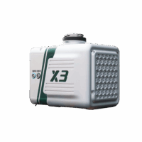 Entry Level drone LiDAR
LiAir X3 + LiGeo Software and Camera – Global Shipping – Free Software Included
Request For Quote Read More -
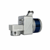 Entry Level drone LiDAR
LiAir X3C-H Drone LiDAR Scanner – 32 Channel LiDAR Sensors – 300M Dection Range
Request For Quote Read More -
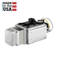
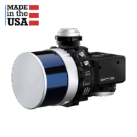 drone lidar with premium INS
RESEPI-HESAI XT32 – From Inertial Labs, Manufactured In USA
Request For Quote Read More -
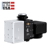
drone lidar with premium INS
RESEPI-HESAI XT32M2X – From Inertial Labs, Manufactured In USA
Request For Quote Read More -
 drone lidar with premium INS
RESEPI-LIVOX AVIA – From Inertial Labs, Manufactured In USA
Request For Quote Read More -
 drone lidar with premium INS
RESEPI-TELEDYNE CL-360HD – From Inertial Labs, Manufactured In USA
Request For Quote Read More -
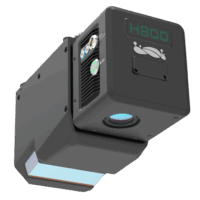 UAV LiDAR Payloads
LiAir H800 Drone LiDAR Scanner – Long Range & High Efficiency UAV Scanning
Request For Quote Read More
-
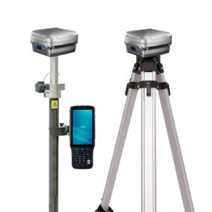
 GNSS Receiver
TokNAV – Economical GNSS Rovers – T5 Series- Global Shipping
Price range: AU$2,650.00 through AU$2,870.00 Excl. GST/VAT View products
-
 LiDAR Point Cloud Processing Software
LiDAR360 Aerial LiDAR Point Cloud Processing & Analyzing Software – 1 Year Subscription
AU$6,665.00 Excl. GST/VAT Add to cart