
OmniSLAM™ Capturer Data Collection Software
-Display Data, Collection, Storage, and Trans- mission on phone. -Support real-time display to avoid repeated scanning. -Monitor the device status in real time.

OmniSLAM™ Viewer - Data Display Software
-Support interaction display of real scenes and point clouds. -Support highspeed loading of point clouds. -Support real scene measurement and point cloud clip. -Support display methods of point clouds by Color, Density, Height.

OmniSLAM™ Mapper - Data Solution Software
-Automatically process data into point clouds, panoramas, and trajectories. -Support coordinate transformation, removal of moving objects, and solution of introduc- ing GCP. -Support point cloud cleaning, WGS84 point clouds generating, and other functions. -Support exporting of Accuracy Report and GCP Inserting Instruction.
OmniSLAM™ Modeller - Automatic Mesh Model Generation
Automatically generate Models by using point clouds with precision level (mm). Support model files in common formats, such as obj, osgb, and others. Introduce the third party Model Refinement tools for processing. No necessary for clusters, a single computer can efficiently build models. Light-Weighted Modeling Solutions of 3D Realscenes. Not applicable to R8.
-
 LiDAR Point Cloud Processing Software
LiDAR360 MLS Mobile/Handheld LiDAR Point Cloud Processing Software – 1 Year Subscription
AU$7,580.00 Excl. GST/VAT Add to cart -
 LiDAR Point Cloud Processing Software
LiPowerline – Powerline Point Cloud Data Analyzing Software – 1 Year Subscription
AU$4,880.00 Excl. GST/VAT Add to cart -
 LiDAR Point Cloud Processing Software
LiDAR360 Aerial LiDAR Point Cloud Processing & Analyzing Software – 1 Year Subscription
AU$6,665.00 Excl. GST/VAT Add to cart
Related products
-
 Mobile LiDAR Scanner
LiMobile M2 – Vehicle Mounted LiDAR Scanner With Planar & Panoramic Camera Integrated
Request For Quote Read More -
 Backpack LiDAR Scanner
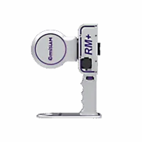
OmniSLAM Explosive-Proof LiDAR Scanner RM+ – Millimeter Accuracy
Request for Quote Read More -
 Handheld LiDAR Scanner
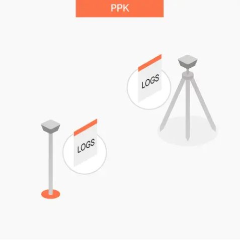
LiGrip O2 Lite Handheld LiDAR Scanner – 3D Gaussian Splatting and RTK, PPK Supported
REQUEST FOR QUOTE Read More -
 Handheld LiDAR Scanner
LiGrip H300/H120 Handheld LiDAR Scanner – Backpack, Vehicle-mounted Platform Supported
Request for Quote Read More