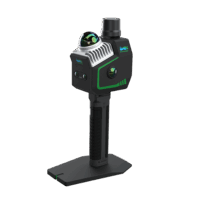
OmniSLAM Explosive-Proof LiDAR Scanner RM+ – Millimeter Accuracy
Request for Quote
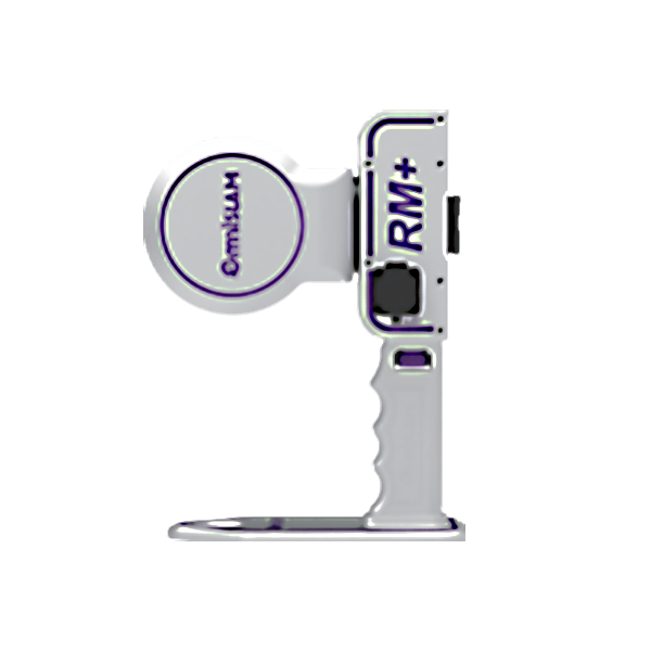
The OmniSLAM RM+ is a high-precision, explosion-proof handheld SLAM LiDAR scanner designed for 3D mapping in GPS-denied, hazardous environments like underground mines. Certified IECEx/ATEX for explosive atmospheres, it delivers millimeter-level accuracy for critical mining applications.
Key Features:
1. World-Realistic Colour
Precision Level (mm)
Rotating single lidar
2. Dynamic Scanning accuracy 2mm
3. 2mm Ultrathin point clouds
4. Maximum 500 thousand/㎡ hyperfine point
clouds
5. Pixel-level texture like a real scene
Delivery Terms:
DAP, Global shipping
Parts included in the package:
1 unit OmniSLAM RM+ handheld LiDAR Scanner;
Backpack Kit;
Warranty:
OEM Warranty, 1 year;
Lead Time:
2 weeks plus transport.
OmniSLAM RM+ Explosive-Proof, Millimeter Accuracy SLAM LiDAR Scanner
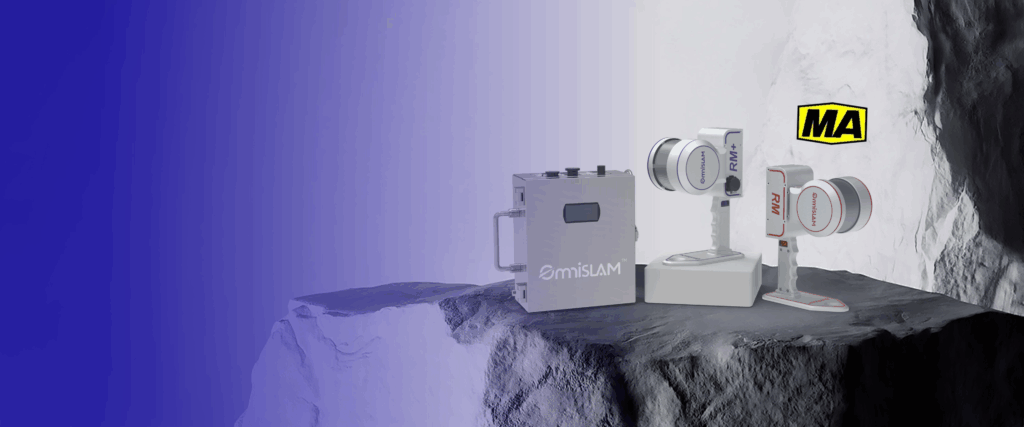
Engineered for Extreme Mining Conditions
The OmniSLAM RM+ is the industry’s premier explosion-proof SLAM LiDAR scanner, purpose-built for underground mining operations. With intrinsic safety certification (IECEx/ATEX) and ruggedized construction, it delivers millimeter-accurate scans in methane-rich environments where conventional scanners fail.
Uncompromised Precision & Range
| Feature | RM+ (Premium) | RM (Standard) |
|---|---|---|
| Accuracy | Millimeter-level | Centimeter-level |
| Point Cloud Quality | Ultrafine detail | High resolution |
| Max Scan Duration | 1 hour / 3km | 1 hour / 3km |
Our proprietary single-rotation LiDAR technology captures complex geometries flawlessly – from bent roadways to vertical shafts – without sacrificing data integrity.
Critical Safety Innovations
Remote Hazard Scanning: Deploy the included Extension Rod to map high-risk zones (e.g., gob areas) from secure distances
Continuous Operation: Industry-leading 3km/1hr scanning capacity for large-scale surveys
Explosive Atmosphere Certified: Safe for Zone 0/1 environments (methane/coal dust)
Demo Video
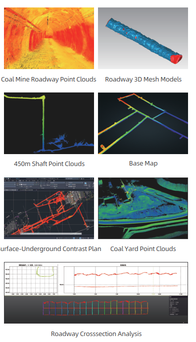
Applications of OmniSLAM RM+ Mining SLAM LiDAR Scanner
“Ultrafine RM+ point clouds enable advanced geotechnical analytics impossible with conventional systems”
Roadway Deformation Analysis: Millimeter-precise convergence monitoring
Slope Stability Assessment: Identify rockfall risks with sub-centimeter fidelity
Backfill Volume Calculation: Automated material estimation with 98% accuracy
Mesh Model Generation: Create simulation-ready 3D models on a single workstation
Contact Us
Error: Contact form not found.
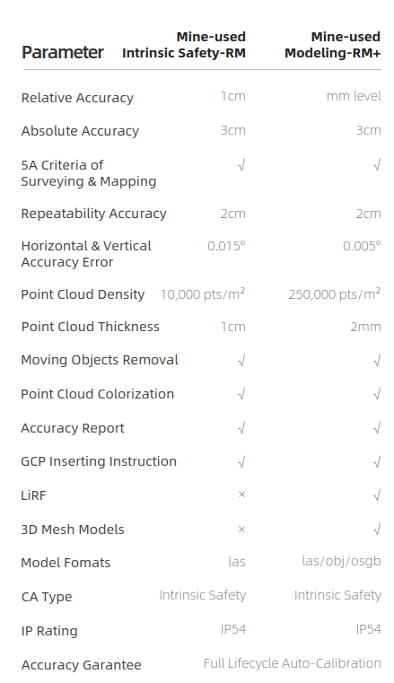
System Parameters of OmniSLAM RM+ Mining SLAM LiDAR Scanner
Required Software for D8 Handheld LiDAR Scanner
Pre-processing Software - Included In Hardware Price
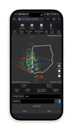
OmniSLAM™ Capturer Data Collection Software
-Display Data, Collection, Storage, and Trans- mission on phone. -Support real-time display to avoid repeated scanning. -Monitor the device status in real time.
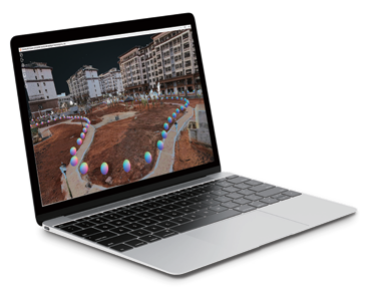
OmniSLAM™ Viewer - Data Display Software
-Support interaction display of real scenes and point clouds. -Support highspeed loading of point clouds. -Support real scene measurement and point cloud clip. -Support display methods of point clouds by Color, Density, Height.
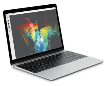
OmniSLAM™ Mapper - Data Solution Software
-Automatically process data into point clouds, panoramas, and trajectories. -Support coordinate transformation, removal of moving objects, and solution of introduc- ing GCP. -Support point cloud cleaning, WGS84 point clouds generating, and other functions. -Support exporting of Accuracy Report and GCP Inserting Instruction.

OmniSLAM™ Modeller - Automatic Mesh Model Generation
Automatically generate Models by using point clouds with precision level (mm). Support model files in common formats, such as obj, osgb, and others. Introduce the third party Model Refinement tools for processing. No necessary for clusters, a single computer can efficiently build models. Light-Weighted Modeling Solutions of 3D Realscenes. Not applicable to R8.
Date management, Post-processing and Analyzing Software - Extra Cost On Top Of Hardware
-
LiDAR Point Cloud Processing Software
LiDAR360 MLS Mobile/Handheld LiDAR Point Cloud Processing Software – 1 Year Subscription
AU$7,580.00 Excl. GST/VAT Add to cart -
LiDAR Point Cloud Processing Software
LiPowerline – Powerline Point Cloud Data Analyzing Software – 1 Year Subscription
AU$4,880.00 Excl. GST/VAT Add to cart -
LiDAR Point Cloud Processing Software
LiDAR360 Aerial LiDAR Point Cloud Processing & Analyzing Software – 1 Year Subscription
AU$6,665.00 Excl. GST/VAT Add to cart
Related products
-
Mobile LiDAR Scanner
LiMobile M2 – Vehicle Mounted LiDAR Scanner With Planar & Panoramic Camera Integrated
Request For Quote Read More -
Backpack LiDAR Scanner
OmniSLAM Vehicle Mounted LiDAR Scanner T8 – Millimeter Accuracy
Request for Quote Read More -
Backpack LiDAR Scanner
OmniSLAM Handheld & Backpack LiDAR Scanner R8+ – Millimeter Accuracy
Request for Quote Read More -
Handheld LiDAR Scanner
LiGrip O2 Lite Handheld LiDAR Scanner – 3D Gaussian Splatting and RTK, PPK Supported
REQUEST FOR QUOTE Read More

