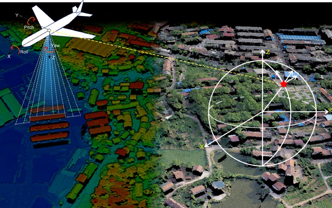
A LiDAR drone that uses Light Detection and Ranging, or LiDAR, is a type of unmanned aerial vehicle (UAV). LiDAR is a type of remote sensing that measures distances and produces fine-grained, three-dimensional point clouds or maps of the Earth’s surface using laser pulses.
LiDAR drones are used in various applications, including Mapping and Surveying, Forestry, Agriculture, Environmental Monitoring, Infrastructure Inspection, Archaeology and Cultural Heritage and Disaster Response and Management etc.
LiDAR drones offer advantages such as speed, accuracy, and the ability to cover vast areas efficiently. They have become an essential tool in various industries where precise and detailed 3D mapping and data collection are required.
Entry Level LiDAR Drone Payloads
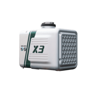
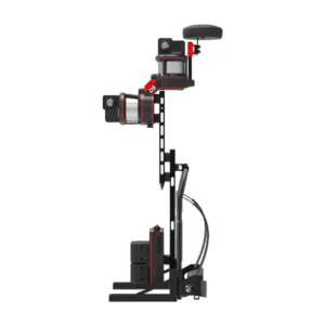
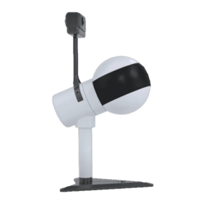
Greenvalley LiAir X3
Laser Sensor: Livox AVIA Range Accuracy: ± 2 cm Detection Range (@100 klx): 190 m @ 10% reflectance 450 m @ 80% reflectance System Accuracy: 5 cm @70m POS System Performance: Attitude: 0.008° (1σ) Azimuth: 0.038° (1σ) Onboard Storage: 128 GB Mounting Platform: DJI’s Matrice 600 Pro,M300 RTK & M210 Weight(excl. battery ): 1.25 kg (Incl. Camera) Field of View: 70.4° (Horizontal) × 4.5° (Vertical)
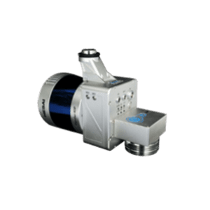
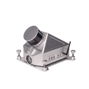
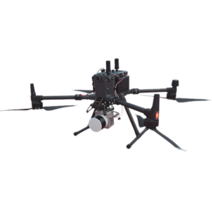
LiAir 220N - Drone Mounted LiDAR System with Hesai Pandar40
Compatible with DJI M300 RTK, & M600
Overview
The LiAir 220N is unmanned aerial LiDAR sensor designed and produced by GreenValley International (GVI). This system features a Hesai Pandar40P laser scanner and it is one of the most cost-effective LiDAR systems in GVI’s LiAir Series. This lightweight 3D surveying and mapping payload was designed with DJI’s Matrice 600 Pro & DJI M300 RTK series platforms. LiAir 220N is able to provide highly accurate 3D point cloud data and is a great fit for applications in a wide variety of industries. And it is also equipped with a high-definition digital camera, which can be used to generate photogrammetry products as well as true color 3D point clouds.
Laser Sensor: Hesai Pandar40P Range Accuracy: ±2 cm Detection Range: 200 m @ 10% reflectance Channels: 40 Power Consumption: 27 W System Accuracy: ± 5 cm POS System Performance: Attitude: 0.008° (1σ) Azimuth: 0.038° (1σ) Camera (Optional): Sony A5100 Weight: 2.0 kg (Incl. Camera) Dimensions (Incl. Camera): 234* 100* 181mm Field of View: 360° (Horizontal) 40° (Vertical) Scan Rate:720,000 pts (Single Return )1,440,000 pts (Dual Return )
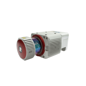
LiHawk - Fully Integrated Riegl VUX-1 LR LiDAR Sensor
Compatible with Fixed-wing Drone
Overview
LiHawk is an aerial land LiDAR surveying system designed for large area and long-range 3D data collection projects. The system is designed to be mounted to a fixed-wing airplane platform or multi-rotor UAV and features a Riegl VUX-1LR laser scanner coupled with a best-in class inertial measurement unit (IMU) for increased point cloud accuracy and precision. LiHawk is wellsuited for projects aiming to map terrain features beneath forest canopies and extract structural parameters from forest LiDAR data. The centimeter-level accuracy of this measurement device will meet the rigorous accuracy demands of civil engineering and critical infrastructure maintenance professionals. And the high-definition digital camera module can be used to generate photogrammetry products as well as true color 3D point clouds during each LiDAR survey.
Laser Sensor: Riegl VUX-1 LR Max. Measurement Rate: 750,000 pts / sec Scan Rate: 10 Hz -200 Hz Field of View: 330° Scan Range: 1350 m @ Reflectance ≥ 60% System Accuracy: Horizontal Accuracy < 10 cm, Vertical Accuracy < 10 cm Flight Height: 200 m POS System Performance: Attitude: 0.005° (1σ) Azimuth: 0.009° (1σ) Weight Incl.Camera: 4.35 kg Dimensions (Main Unit): 297 * 180 * 147 mm Flight Time: More than one hour Camera: SONY A7RII (24 mm prime lens) Post-Processing Software (Optional): LiDAR360 & LiPowerline
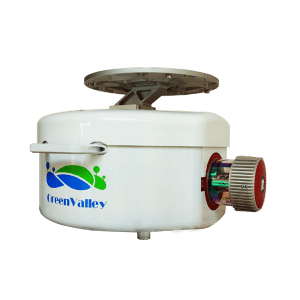
LiEagle - Aerial Survey LiDAR for Large Projects
Designed for Helicopter Mounting Application
Overview
LiEagle is an aerial survey LiDAR scanner for surveying and it is designed for large area and long-range 3D data collection projects. The system is designed to be mounted to a helicopter platform and features a Riegl VUX-1LR laser scanner coupled with a best-in-class inertial measurement unit (IMU) for increased point cloud accuracy and precision. The LiEagle is well-suited for projects aiming to map terrain features beneath forest canopies and extract structural parameters from forest LiDAR data. The centimeter-level accuracy of this measurement device will meet the rigorous accuracy demands of civil engineering and critical infrastructure maintenance professionals. And an optional high-definition (50 megapixels) digital camera module can be used to generate photogrammetry products as well as true color 3D point clouds during each LiDAR survey.
Laser Sensor: Riegl VUX-1 LR Max. Measurement Rate: 750,000 pts / sec Scan Rate: 10 Hz -200 Hz Field of View: 330° Scan Range: 1350 m @ Reflectance ≥ 60% Flight Height: 200 m System Accuracy: Horizontal Accuracy < 10 cm Horizontal Accuracy < 10 cm POS System Performance: Attitude: 0.005° (1σ) Azimuth: 0.009° (1σ) Weight: 17 kg Dimensions (Main Unit): 505 * 492 * 319 mm Power Consumption: 210 W Camera: Canon 5DSR Acquisition Software: LiAcquire-VUX Post-Processing Software (Optional):LiDAR360 & LiPowerline
LiGeoReference - Pre-processing Software for Point Cloud Captured by Drone LiDAR Scanners
Overview
LiGeoreference is proprietary software that allows users to convert range measurements and POS information from mobile, UAV or airborne laser scanning systems to georeferenced coordinates. The software provides flexible solutions for generating 3D point clouds in LAS or LiData formats with LiDAR returns mapped to a userspecified datum ( e.g. WGS 1984) and/ or projection system ( e.g. UTM). LiGeoreference also provides data fusion tools to assign LiDAR points with color information based on the color imagery integrated into the laser scanning system. Laser scanners from multiple providers, such as Riegl and Velodyne, are supported.
• Automatically calculate the georeference coordinates of drone LiDAR point cloud from mobile, UAV orairborne laser scanning systems. • Fuse LiDAR point clouds with RGB imagery to assigned color information to each LiDAR point. • Support the output of both geographic coordinates and projected coordinates. • Support the process of laser scanning measurements from multiple laser scanner providers.