
What is Drone Inspection?
Applications of Drone Inspections?
There are numerous applications for drone inspections, including:
- Drones can be used to inspect bridges, roads, railways and other vital infrastructure. Engineers and surveyors can assess the condition of these structures for maintenance and safety purposes by capturing high-resolution images and videos using UAV inspection drone devices.
- The exteriors of structures, including their roofs and facades, can be inspected using drones. Drone roof inspection technology can detect issues such as fractures, leaks and structural damage and determine if maintenance or repairs are required.
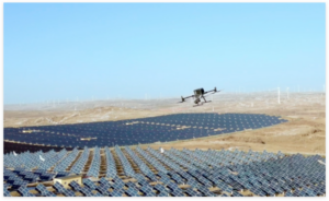
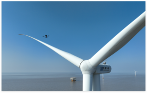
- Power cables, pipelines and other utilities are frequently inspected using drones. Pipe and cable drone inspections can detect flaws, corrosion and damage without requiring manual inspections, thereby reducing the danger to workers.
- Drones can be outfitted with sensors to monitor environmental conditions, including air quality, water quality and wildlife populations. Using UAV drone survey technology for these purposes is especially beneficial in inaccessible or remote areas.
- Drones are used in agriculture for crop monitoring, disease detection and estimation. Our UAV drone survey technology can provide producers with valuable information for precision agriculture.
- UAV survey drones are used in the mining industry to assess the progress of excavation, monitor stockpiles and survey the terrain for productivity and safety.
- Aerial imagery drones equipped with cameras and thermal imaging can aid in locating missing persons and assessing disaster-stricken areas during search and rescue operations.
- Drones can be used for drone pipeline inspections, including offshore platform inspections, pipeline monitoring and environmental assessments in the oil and gas industry.
- Drones can be used to track and monitor wildlife populations, study animal behaviour and combat exploitation.
What Payload Do We Normally Use for a Drone Inspection?
Depending on the specific requirements of the inspection mission, drones used for inspection can carry a variety of payload types. Here are some prevalent drone inspection payload types:
Digital Cameras
- RGB Cameras: These standard colour cameras are suitable for visual inspections and documentation, as they capture colour images and videos.
- Infrared (IR) Cameras: IR cameras detect heat signatures and are used to identify temperature variations in structures or equipment during thermal inspections.
- Multispectral Cameras: Multispectral cameras capture images at multiple wavelengths, allowing for a comprehensive analysis of plant health in agriculture and environmental assessments.
Light Detection and Ranging (LiDAR):
By measuring the time it takes for laser pulses to return from objects, LiDAR sensors produce high-resolution 3D maps of the environment. This is beneficial for terrain mapping, modelling of infrastructure and precise measurements.
The selection of payload is determined by the inspection’s objectives, the environment in which it will be conducted and the data necessary for analysis. As inspection drone technology continues to advance, new and more specialised instruments for a wide variety of inspection applications are created.
About Our Drone Surveying Service
LiDAR Solutions offers premium drone surveying services that provide clients across many different industries with accurate aerial survey data they can rely on. We use state-of-the-art UAV survey technology to accurately capture images in multiple formats, giving you a clear and precise understanding of the land and its surroundings. Call us today to book our agricultural, urban planning or construction drone services.
Why Choose Us?
LiDAR Solutions is a trusted Australian UAV inspection service provider. We’ve earned a reputation as one of the leading aerial mapping companies in the business due to the high quality of our aerial imagery drone inspection services. We’ve worked with clients to provide urban planning, agricultural and construction drone photography services, delivering detailed and accurate visual reports. Get in touch with us today to speak to one of the best drone companies in Australia and New Zealand.
Assets We Inspect with Drone
Request Information and Quote
Contact Us Today
Call LiDAR Solutions today on 0412 752 033 or contact us online for more information on our drone mapping and drone videography service.