

LiGrip SE Handheld LiDAR Scanner – Backpack, Frontpack and Pole-mount Supported
Request for Quote
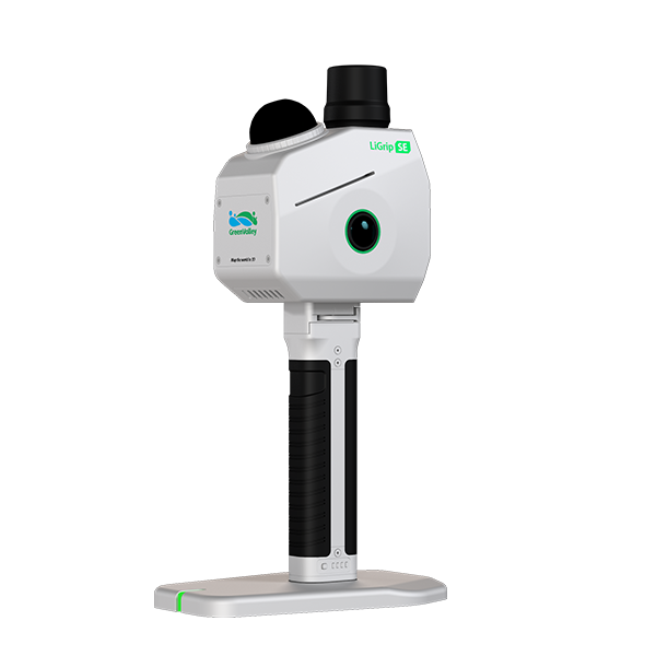
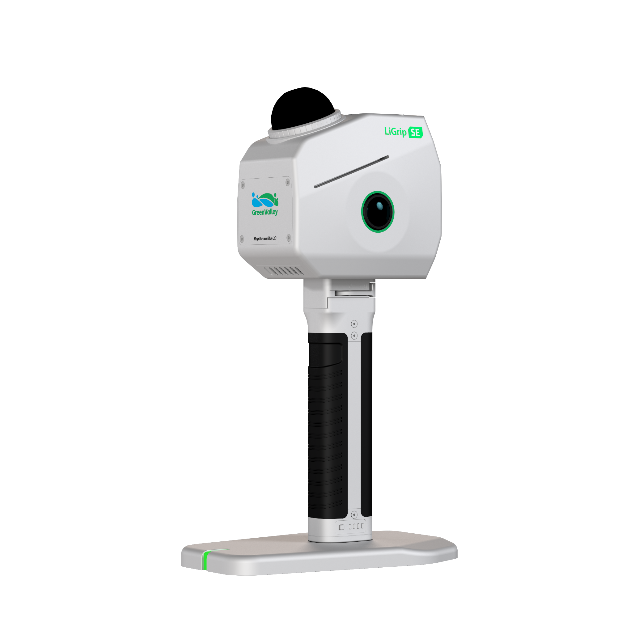
Introducing the LiGrip SE—the next-generation handheld laser scanner engineered by GreenValley International. Whether you are mapping complex indoor spaces, dense forestry, or harsh outdoor environments, the LiGrip SE delivers survey-grade accuracy without the need for rework. It combines professional-grade SLAM algorithms with a user-friendly, rugged design to turn every scanning task into a simple, reliable workflow.
Delivery Terms:
DAP, Global shipping
Parts included in the package:
1 unit LiGrip SE handheld LiDAR Scanner;
LiFuser Pre-processing software (Permanent License);
Warranty:
OEM Warranty, 1 year;
Lead Time:
Contact us for availability
Key Features - LiGrip SE LiDAR Scanner
Dual 12MP Panoramic Cameras – Capture vivid, true-to-life colors. Unlike standard colorization, the SE’s high-definition fisheye cameras unlock advanced capabilities like 3D Gaussian Splatting (3DGS) and detailed image analysis.
Surveying-Grade SLAM Algorithm – Powered by GreenValley International’s proprietary algorithms, the SE outperforms open-source solutions in challenging environments (mines, corridors, multi-room buildings).
Relative Accuracy: 2cm
Absolute Accuracy: 5cm
Repeatability: 3cm
Built for the Field (IP54) – With an IP54 water and dust resistance rating and an operating range of -20°C to 40°C, the SE performs reliably in rain, snow, and dusty job sites.
Turnkey Software Solution – No more switching between multiple tools. From PPK processing to SLAM-based merging and GCP picking, our software delivers final outputs (LAS, E57, 3DGS, Mesh) directly.
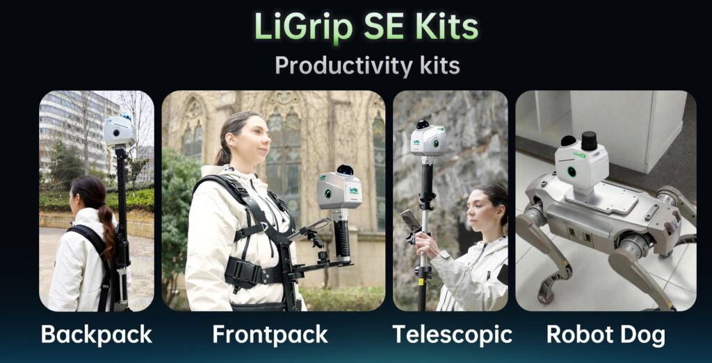
Multi-Modal Deployment – Adapts to any scenario with productivity kits:
Backpack Kit: Dual batteries for 5-hour endurance.
Frontpack Kit: Hands-free operation for complex environments.
Telescopic Pole Kit: Extended reach for facades and stockpiles.
Robot Dog Compatibility: Safe data capture in hazardous areas.
Contact Us - NZ
Technical Specifications
| Feature | Specification |
|---|---|
| Weight | 1.3 kg (with GNSS) |
| Cameras | Dual 12MP Fisheye |
| Relative Accuracy | 2 cm |
| Absolute Accuracy | 5 cm (with GNSS/PPK) |
| IP Rating | IP54 (Water & Dust Resistant) |
| Battery Life | 2.5 hours (Single) / 5 hours (Backpack Kit) |
| Storage | 256 GB SSD (Type-C) |
| Output Formats | LiData, LAS, E57, TXT, JPG, OSGB, PLY (3DGS) |
| GNSS Support | RTK/PPK (SE RTK Version) – BDS, GPS, GLONASS, Galileo |
LiGrip SE Kits
How to select the right scanner for your business
LiGrip SE, O2 Lite or O2
Quick Scenario Recommendation
| If you need… | Choose… |
|---|---|
| Lightest scanner, general purpose, low budget, robot dog or pole use | LiGrip SE |
| Real‑time point cloud, better angular accuracy, medium budget | LiGrip O2‑Lite |
| Highest precision, car/drone mounting, small object details, unlimited scenarios | LiGrip O2 |
LiGrip SE – Lightweight & Cost‑Effective Daily Workhorse
Key strengths: Ultra‑light (1.3 kg), IP54 rugged, dual 12MP cameras, surveying‑grade SLAM (2cm relative, 5cm absolute), 2.5h battery (5h with backpack), supports backpack/frontpack/telescopic pole/robot dog.
Best for:
- General indoor mapping – Multi‑room apartments, office floors, shopping malls (pure SLAM works well without GNSS).
- Harsh outdoor environments – Rain, dust, snow, temperatures from -20°C to 40°C (IP54).
- Stockpile & facade measurement – Using telescopic pole kit for extended reach.
- Dangerous or confined areas – Robot dog deployment for mines, tunnels, or post‑disaster scenes.
- Budget‑conscious projects – Where “no rework” and turnkey software (no third‑party tools) are prioritized over ultra‑high precision.
LiGrip O2‑Lite – Balanced Mid‑Range Performer
Key strengths: 3cm absolute accuracy, 2cm repeatability, 0.025° horizontality/verticality, real‑time point cloud, 512GB storage, 2h battery (4h dual), supports same kits as SE.
Best for:
- Precision surveying without GNSS – Real‑time feedback allows on‑site quality check.
- Larger area mapping – Extended storage and reliable SLAM for corridors, campuses, or underground garages.
- Users who need better angular accuracy – 0.025° vs SE’s 0.05°, making it more suitable for projects requiring straighter walls and better perpendicularity (e.g., as‑built BIM).
- Transition from hobbyist to professional – More accuracy than SE but lighter and less expensive than full O2.
LiGrip O2 – Professional, All‑Scenario Flagship
Key strengths: XT LiDAR unit, external ultra‑high‑precision INS, 3×12MP RGB + 2×1.3MP VSLAM cameras, 3cm absolute / 1cm relative / 2cm repeatability, 0.015° horizontality, multi‑platform support (backpack, frontpack, car, drone, telescopic pole, robot dog), 512GB storage, IP64.
Best for:
- High‑precision engineering – Infrastructure inspection, rail/road mapping, bridge deformation monitoring (1cm relative accuracy).
- Small object capture – Enhanced intensity and VSLAM cameras for fine details (utility poles, traffic signs, historical artifacts).
- All‑scenario adaptation (MLF‑SLAM) – Seamlessly switches between indoor, outdoor, open pit, forest, and urban canyons.
- Drone and car‑based mobile mapping – Unlike SE/O2‑Lite, O2 supports vehicle and UAV mounts for large‑scale corridor or city mapping.
- Best 3DGS (Gaussian Splatting) performance – Superior image quality and point cloud density for photorealistic digital twins.
Related products
-
 Backpack LiDAR Scanner
OmniSLAM Vehicle Mounted LiDAR Scanner T8 – Millimeter Accuracy
Request for Quote Read More -
 Backpack LiDAR Scanner
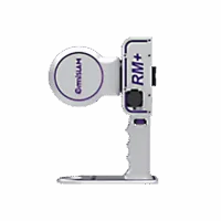
OmniSLAM Explosive-Proof LiDAR Scanner RM+ – Millimeter Accuracy
Request for Quote Read More -
 Handheld LiDAR Scanner
LiGrip O2 Handheld LiDAR Scanner – Backpack, Vehicle-mounted Platform Supported
Request for Quote Read More -
 Handheld LiDAR Scanner
LiGrip O2 Lite Handheld LiDAR Scanner – 3D Gaussian Splatting and RTK, PPK Supported
REQUEST FOR QUOTE Read More