


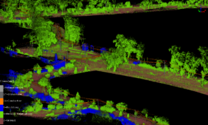
Unlocking Road Survey Efficiency with Advanced LiDAR Technology - NZ
We’re thrilled to announce the successful completion of a comprehensive wind turbine transport route assessment by using cutting-edge vehicle-mounted LiDAR technology for our valued customer,
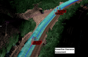
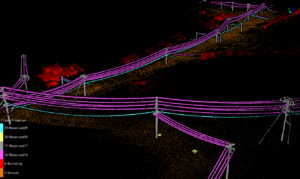
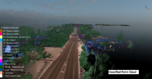
How did mobile LiDAR scanning speed up and improve the powerline 3D model creation and encrochment assessment? - NZ
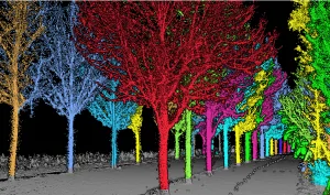
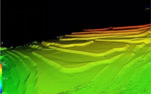
What is mobile LiDAR Scanning system? A mobile lidar scanning system is a technique that captures highly comprehensive and precise 3D data of the surroundings
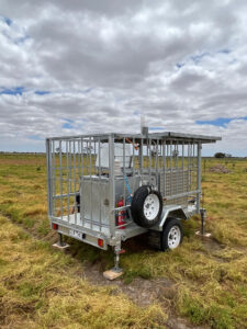
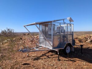
Turn-key Molas B300 Wind LiDAR System Passed The Performance - NZ
The performance test for Molas B300 wind LiDAR system has been done between end of June to End of September near Geelong, Victoria, Australia together