LiAir X3 + LiGeo Software and Camera – Global Shipping
Request For Quote
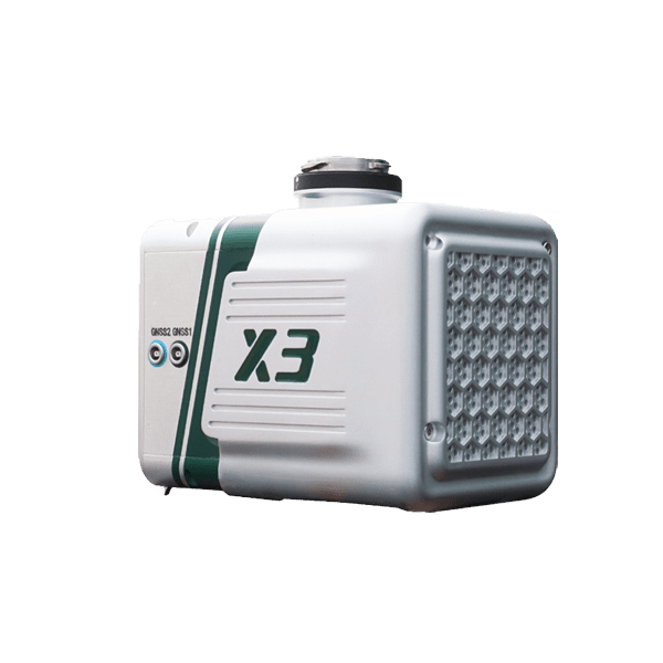
LiAir X3 is the newest compact, high-performance unit in the LiAir series by GreenValley International. It adopts a new integrated design style and integrates lightweight LiDAR, self-developed inertial navigation, a high-resolution mapping camera, and onboard computer systems providing new levels of efficiency.
Delivery Terms:
DAP, Global shipping
Parts included in the package:
LiAir X3 LiDAR Scanning System with Camera;
LiGeoReference Pre-processing Software (Permanent License);
Warranty:
OEM Warranty, 1 year;
Lead Time:
2 weeks plus transport.
Content
Key Features of LiAir X3-H
Lightweight & Simple
Integrated simple yet rugged design, allowing for protection against the elements with an IP64 rating. The operation interface is straightforward, allowing one touch operation for maximum efficiency.
New Camera, providing ultra-clear picture quality
Built-in new high-resolution custom mapping camera, the image resolution is upgraded from 24 Megapixels to 26 Megapixels, allowing for high-quality true-color point clouds as well as orthophotos for Photogrammetry.
Autonomous terrain and powerline following
Autonmous terrain following
Autonmous powerline following
General Specification of LiAir X3 Drone LiDAR Scanner
Laser Sensor: Livox AVIA
Range Accuracy: ± 2 cm
Detection Range (@100 klx):
190 m @ 10% reflectance
450 m @ 80% reflectance
System Accuracy: ± 5 cm @70m
POS System Performance:
Attitude: 0.008° (1σ)
Azimuth: 0.038° (1σ)
Onboard Storage: 128 GB
Mounting Platform:
DJI’s Matrice 600 Pro,M300 RTK & M210
Weight(excl. battery ): 1.1 kg (Incl. Camera)
Field of View: 70.4° (Horizontal) × 4.5° (Vertical)
Downloads for LiAir X3 Drone LiDAR Scanner
Brochure
Click HERE to download LiAir Brochure from Google Drive.
User Manual
Sample Data
Required Software for LiAir X3 Drone LiDAR Scanner
Pre-processing Software
Date management, Post-processing and Analyzing Software
Related products
- UAV LiDAR Payloads
LiAir H800 Drone LiDAR Scanner – Long Range
Rated 0 out of 5US$65,000.00 Excl. GST/VAT Add to basket - drone lidar with premium INS
RESEPI-HESAI XT32 – From Inertial Labs, Manufactured In USA
Rated 0 out of 5Request For Quote - Riegl LiDAR Scanning System
LiHawk Fixed-Wing Drone LiDAR Scanner – Riegl VUX-1 LR
Rated 0 out of 5Request For Quote
