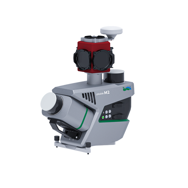
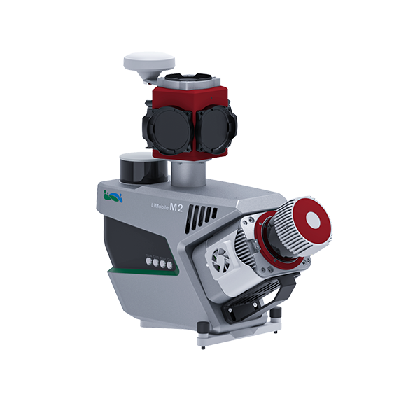
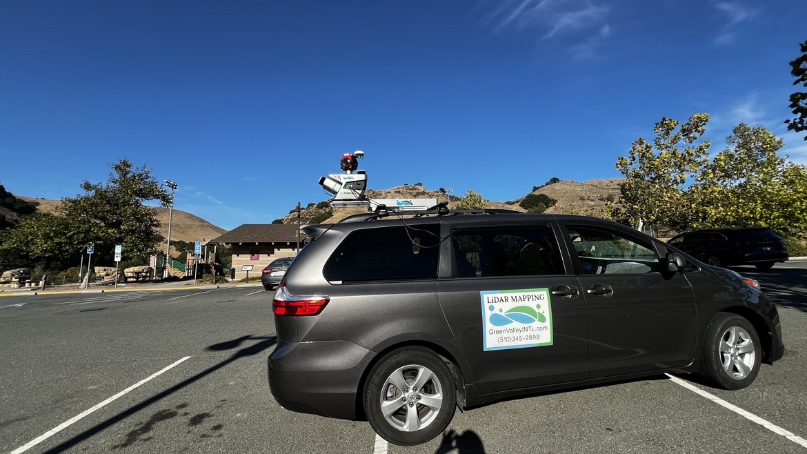
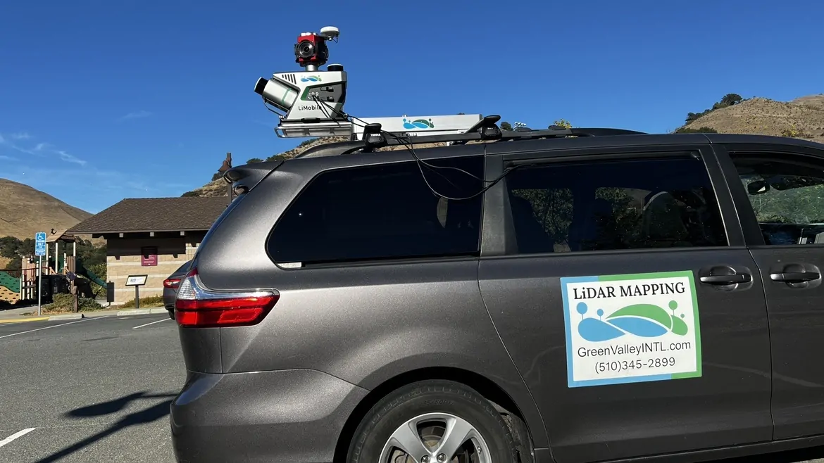
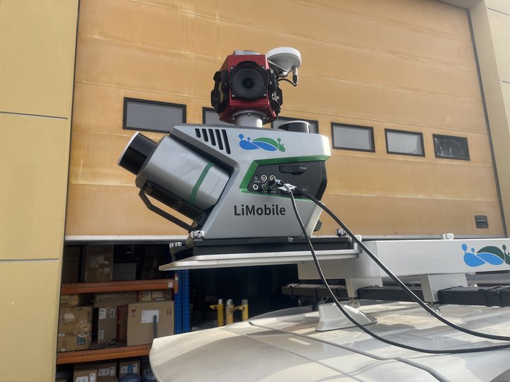
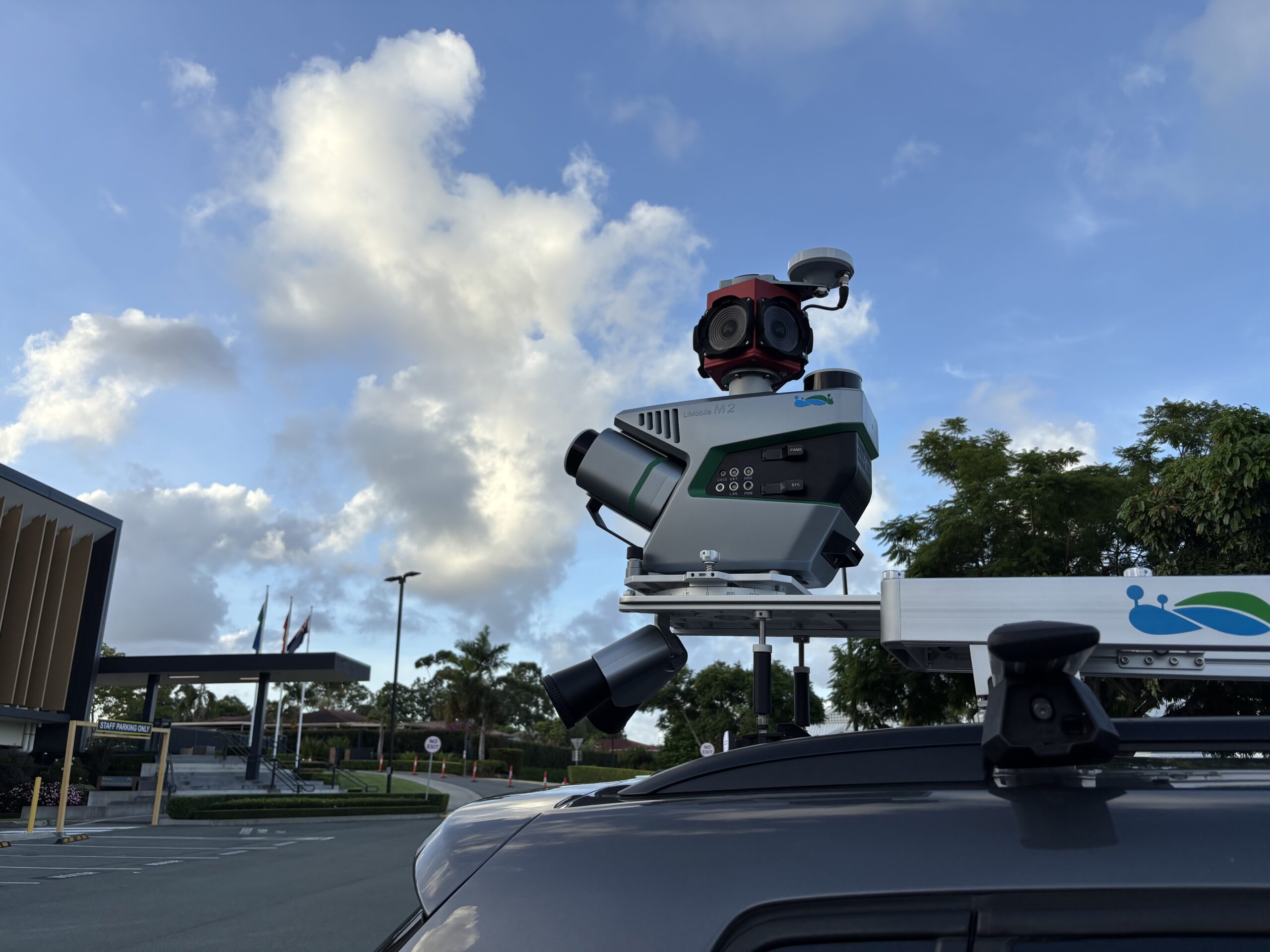
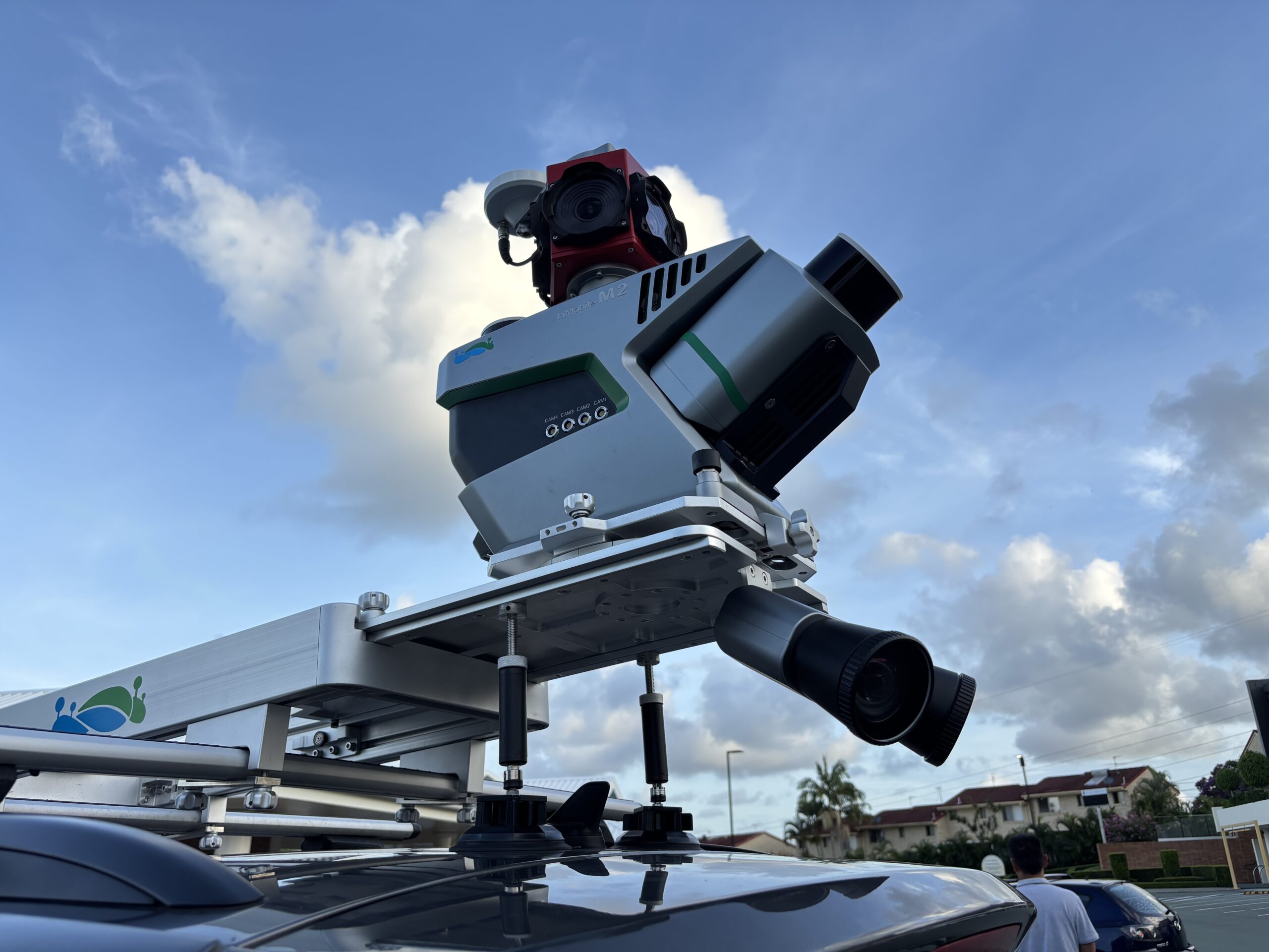
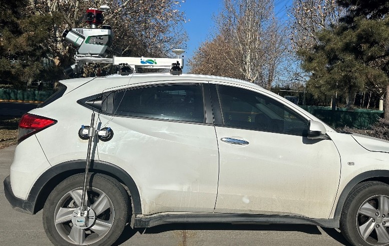
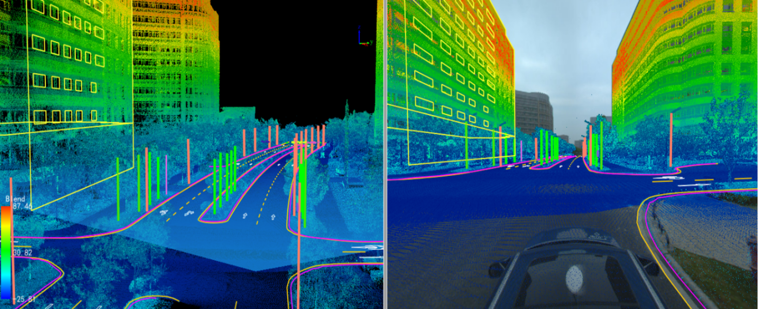
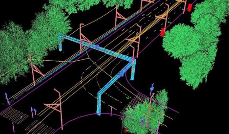
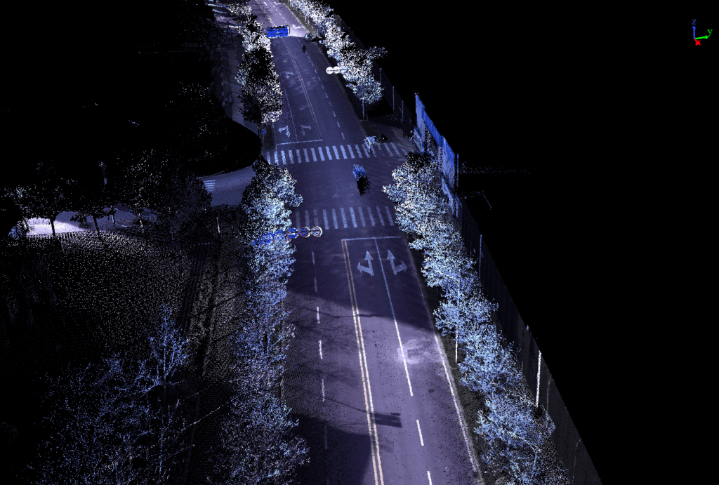
The LiMobile M2 affordable mobile laser scanning (MLS) system is equipped with two LiDAR sensors (one tilted at a 30-degree angle and one positioned horizontally) and a Ladybug5+ panoramic camera, enabling efficient 3D mapping of roads and surrounding environments. Even in GPS-denied areas, high-precision scanning can be achieved with the help of laser SLAM. It also provides multiple expansion interfaces and can be installed on various types of vehicles. Paired with GVI’s self-developed LiDAR360MLS software, it enables a one-stop data processing to deliver industry results, supporting applications such as road asset extraction, urban power distribution line analysis, urban forestry management, smart transportation, and more.


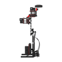 Backpack LiDAR Scanner
 Backpack LiDAR Scanner
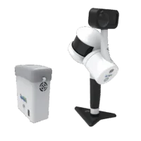 Handheld LiDAR Scanner
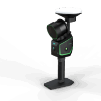 Handheld LiDAR Scanner